Sooke Basin facts for kids
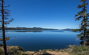
Sooke Basin is a small area of water, about 10 square kilometers, located on the southern part of Vancouver Island in British Columbia, Canada. It connects to the Strait of Juan de Fuca through a narrow, natural waterway called Sooke Harbour, which is about 4 kilometers long.
Contents
Exploring Sooke Basin's Geography
Sooke Basin is a body of salt water found between the towns of Sooke and East Sooke. Most of the shores around Sooke Basin are rocky. However, along the northern side, you can find lovely sandy beaches. Other parts of the basin have muddy or pebbly beaches.
Islands in Sooke Basin
There are three small islands in the southeastern part of the basin. These islands are known as the Goodridge Islands.
Discovering Sooke Basin's Coves
Roche Cove: A Park Gem
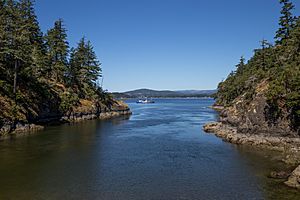
Roche Cove is a small, shallow cove located on the eastern side of Sooke Basin. This cove is the main feature of the 143-hectare Roche Cove Regional Park. A small bridge crosses the narrow entrance to Roche Cove. The water currents here can be quite strong because of the tides. Small powerboats can pass through the entrance when the tide is mid-level or high. Roche Cove is located right where Sooke and East Sooke meet.
Anderson Cove: Public Boat Launch
Anderson Cove is another small, shallow cove found in the southeast part of Sooke Basin. Its entrance is very narrow and shallow. However, if you know the area well, you can pass through it at mid or high tide. Expensive homes in East Sooke are built along the shores of Anderson Cove. This cove is also home to the only public boat launch in all of Sooke Basin and its coves.
Coopers Cove: A Peninsula's Story
Coopers Cove is formed by the Goodridge Peninsula. This peninsula used to be the location of a sawmill and was planned to become a resort. The Goodridge Peninsula was originally an island that was later connected to the shore of Vancouver Island.
Sooke Basin's History
Sooke Basin gets its name from the T'Sou-ke Nation, who are part of the Coast Salish peoples. These native inhabitants had a thriving community here. It is believed they lived in this area for thousands of years before Europeans arrived.
The first known Europeans to enter Sooke Basin were the Spanish. This happened during an expedition in 1790 led by Manuel Quimper on the ship Princesa Real. Juan Carrasco was the pilot on this journey. The Spanish named Sooke Basin "Puerta de Revilla Gigedo." They did this to honor the Viceroy of Viceroyalty of New Spain, Güemes Padilla Horcasitas, Count of Revillagigedo.
Communities Around Sooke Basin
The northern part of Sooke Basin is within the area managed by the municipality of Sooke. The southern part of the basin is located in the East Sooke section of the Juan de Fuca Electoral Area.
 | Charles R. Drew |
 | Benjamin Banneker |
 | Jane C. Wright |
 | Roger Arliner Young |


