
Sool facts for kids
Quick facts for kids
Sool
|
|
|---|---|
|
Region
|
|

|
|

Location in Somaliland
|
|
| Country | |
| Administrative centre | Las Anod |
| Area | |
| • Total | 39,240 km2 (15,150 sq mi) |
| Population
(2014)
|
|
| • Total | 767,428 |
| Time zone | UTC+3 (EAT) |
| HDI (2021) | 0.338 low · 8th of 18 |
Sool (Somali: Sool, Arabic: صول) is a region in the southeastern part of Somaliland and northwestern Somalia. It shares borders with Togdheer to the west, Sanaag to the north, Ethiopia to the south, and Nugal and Bari to the east. The main city and capital of Sool is Las Anod.
This region is currently claimed by both the self-declared Republic of Somaliland and Puntland, which is a state within Somalia. Because of this, parts of Sool are controlled by each of these governments.
Contents
Who Controls Sool?
The Sool region is a place of disagreement between Somaliland and Puntland. Somaliland says the region belongs to it because of the old borders of the British Somaliland protectorate. Puntland, however, claims the area because it is home to the Harti clan, which helped create Puntland in 1998.
Over the years, there have been conflicts in the region. In 2003, Puntland sent soldiers to Las Anod and took control of the city. Later, in 2007, Somaliland's military took control of Las Anod.
Fighting also happened near Tukaraq. In 2018, the Somaliland army captured Tukaraq. By April 2019, the Somaliland army also took control of Taleh. In May 2022, Somaliland captured Bo'ame, which was the last town in the region not under their control.
Because of these long-lasting disagreements, many people from the Dhulbahante and Warsangeli clans who live in Sool and eastern Sanaag do not fully support either Somaliland or Puntland.
A Look at Sool's History

From 1944 to 1974, the area we now call Sool was known as the Las Anod district. It was one of three districts that were under the protection of the British. The other two districts were Burao and Hargeysa.
In 1974, most of Sool became part of a larger region called Nugaal. The capital of Nugaal was Garowe. Then, in 1984, Sool was made into its own separate region. Its capital city became Las Anod.
People of Sool
The Sool region is mostly home to the Dhulbahante clan. One expert, Michael Walls, said that Sool has a very high number of people from the same family group, which is quite rare in the Somali Horn region.
The Habr Je'lo clan, which is part of the Isaaq family, lives in most of the Aynaba district. They share this area with the Dhulbahante and Habar Yonis clans. This includes Aynaba, which is the second-largest town in the region.
The Dhulbahante, a group within the Harti Darod clan, mainly live in the Taleh, Hudun, and Las Anod districts of Sool. They make up over 80% of the people in the region. A smaller group called the Fiqishini, from the Habar Gidir Hawiye clan, lives in a small area around Adhi'adeye. They are connected to the Baho Nugaaled Dhulbahante.
Districts of Sool
The Sool region is divided into 4 main districts:
| District | Grade | Capital City | Notes | Location |
|---|---|---|---|---|
| Las Anod | A | Las Anod | This is the capital of the Sool region. | .svg) |
| Aynabo | B | Aynaba | .svg) |
|
| Hudun | C | Hudun | .svg) |
|
| Taleh | C | Taleh | .svg) |
Villages in Sool
- Karindabaylweyn
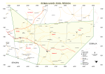
Maps of Sool Region
- Map of Sool Region
-

More to Explore
- Administrative divisions of Somaliland
- Regions of Somaliland
- Districts of Somaliland
- Somalia–Somaliland border
See also
 In Spanish: Región de Sool para niños
