Butler Township, Michigan facts for kids
Quick facts for kids
Butler Township, Michigan
|
|
|---|---|

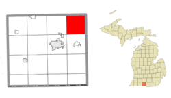
Location within Branch County
|
|
| Country | United States |
| State | Michigan |
| County | Branch |
| Area | |
| • Total | 35.8 sq mi (92.6 km2) |
| • Land | 35.6 sq mi (92.3 km2) |
| • Water | 0.1 sq mi (0.3 km2) |
| Elevation | 1,010 ft (308 m) |
| Population
(2020)
|
|
| • Total | 1,417 |
| • Density | 39.63/sq mi (15.302/km2) |
| Time zone | UTC-5 (Eastern (EST)) |
| • Summer (DST) | UTC-4 (EDT) |
| FIPS code | 26-12140 |
| GNIS feature ID | 1626013 |
Butler Township is a small community located in the northeastern part of Branch County, in the state of Michigan. It's a type of local government area, often called a civil township. According to the 2020 census, about 1,417 people live here.
Contents
Exploring Butler Township's Communities
Butler Township is mostly a farming area. You won't find any big cities or towns here. Instead, there are a few smaller places that aren't officially separate towns. These are called unincorporated communities.
- Butler is one of these communities. You can find it at these coordinates: 42°03′28″N 84°51′55″W / 42.05778°N 84.86528°W.
- South Butler is another small settlement. Its location is 42°01′20″N 84°53′06″W / 42.02222°N 84.88500°W.
- There was also a place called Faxton. It had a post office from 1893 to 1900, but it's no longer active.
A Look Back: Butler Township's History
Butler Township was officially formed way back in 1835. It got its name from a town in New York, called Butler, New York. This is because many of the first people who settled here came from that New York town. There was also a settlement named Dayburg that started here in 1845.
Discovering Butler Township's Geography
Butler Township is a place with interesting natural features. It has several small streams and creeks that flow into the St. Joseph River. These include the north and south branches of Hog Creek, Tekonsha Creek, and Soap Creek.
The United States Census Bureau tells us that the township covers a total area of about 92.6 square kilometers (or 35.8 square miles). Most of this area, about 92.3 square kilometers (35.6 square miles), is land. Only a small part, about 0.3 square kilometers (0.1 square miles), is water.
Who Lives in Butler Township?
| Historical population | |||
|---|---|---|---|
| Census | Pop. | %± | |
| 2000 | 1,362 | — | |
| 2010 | 1,467 | 7.7% | |
| 2020 | 1,417 | −3.4% | |
Let's look at the people who call Butler Township home. In 2000, there were 1,362 people living here. These people lived in 431 households, and 349 of those were families.
The population density was about 38.2 people per square mile (14.7 people per square kilometer). Most people living in the township were White (about 97%). A small number were African American, Native American, or Asian. Some people also identified with two or more races.
In 2000, about 43% of households had children under 18 living with them. Most households (68.4%) were married couples living together. The average household had about 3.16 people.
The median age in the township was 32 years old. This means half the people were younger than 32, and half were older.
See also
 In Spanish: Municipio de Butler (Míchigan) para niños


