South Fourche La Fave River facts for kids
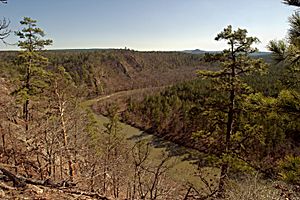
The South Fourche La Fave River is a stream located in the beautiful Ouachita Mountains of Arkansas. It flows through parts of Perry and Yell counties. This river is a smaller stream that flows into a larger one, making it a tributary of the Fourche La Fave River. Think of it like a smaller branch joining a bigger tree trunk!
Contents
Where the River Starts
The South Fourche La Fave River begins high up in the mountains. Its starting point, called the headwaters, is found southwest of the Allen Peak Lookout Tower. From there, the water flows generally towards the east and northeast.
River's Journey Through Arkansas
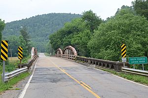
As the river travels, it passes under Arkansas Highway 27 just south of a place called Onyx. It then flows alongside Arkansas Highway 314, moving past small communities like Steve and Hollis.
Meeting the Main River
Further along its path, the river goes under Arkansas Route 7. It then turns north and east before finally joining with the main Fourche La Fave River. This meeting point, called a confluence, is located east of Nimrod.
How Much Water Flows
The amount of water flowing in the South Fourche La Fave River changes throughout the year. On average, about 295 cubic feet of water pass by each second. This measurement comes from a special station near Hollis, which is run by the USGS (United States Geological Survey). They help us understand how much water is in our rivers!
 | Claudette Colvin |
 | Myrlie Evers-Williams |
 | Alberta Odell Jones |


