South Park View, Kentucky facts for kids
Quick facts for kids
South Park View, Kentucky
|
|
|---|---|

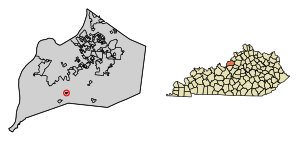
Location of South Park View in Jefferson County, Kentucky
|
|
| Country | United States |
| State | Kentucky |
| County | Jefferson |
| Area | |
| • Total | 0.12 sq mi (0.32 km2) |
| • Land | 0.12 sq mi (0.32 km2) |
| • Water | 0.00 sq mi (0.00 km2) |
| Elevation | 495 ft (151 m) |
| Population
(2020)
|
|
| • Total | 0 |
| • Density | 0.00/sq mi (0.00/km2) |
| Time zone | UTC-5 (Eastern (EST)) |
| • Summer (DST) | UTC-4 (EDT) |
| ZIP Code |
40219
|
| FIPS code | 21-72138 |
| GNIS feature ID | 2405492 |
South Park View is a small city in Jefferson County, Kentucky, Kentucky, United States. It is known for being one of the smallest cities in Kentucky. It is also one of the few places in the U.S. that currently has no people living there. The city was named because it is close to South Park Hill. This hill is the highest point in Jefferson County.
History of South Park View
South Park View officially became a city in April 1961. For many years, it was a quiet place where people lived. However, things changed when the Louisville International Airport expanded. The airport's new runways caused a lot of noise. This noise was considered "significant" by the government.
Because of the noise, people living in South Park View had to move. Their homes were replaced by an industrial park. This change caused the city's population to drop a lot. In 2000, there were 196 people. By 2010, only 7 people lived there. By the 2020 census, no one was officially living in South Park View.
Where is South Park View?
South Park View is located in the southern part of Jefferson County. It is about 11 miles (18 km) south of downtown Louisville. It is also about 4 miles (6.4 km) south of Louisville International Airport.
The city is very small. It covers an area of about 0.1 square miles (0.3 square kilometers). All of this area is land.
How Many People Live There?
| Historical population | |||
|---|---|---|---|
| Census | Pop. | %± | |
| 1970 | 287 | — | |
| 1980 | 248 | −13.6% | |
| 1990 | 214 | −13.7% | |
| 2000 | 196 | −8.4% | |
| 2010 | 7 | −96.4% | |
| 2020 | 0 | −100.0% | |
| U.S. Decennial Census | |||
Over the years, the number of people living in South Park View changed a lot. In 1970, there were 287 residents. The population slowly went down over the next few decades. By 2000, 196 people lived in the city.
After 2000, the population dropped very quickly. This was due to the airport expansion. By 2010, only 7 people remained. In the 2020 census, the official population was 0. This means no one was counted as living there at that time.
See also
 In Spanish: South Park View (Kentucky) para niños
 | Bessie Coleman |
 | Spann Watson |
 | Jill E. Brown |
 | Sherman W. White |


