Sowbridge Branch (Primehook Creek tributary) facts for kids
Quick facts for kids Sowbridge Branch |
|
|---|---|
|
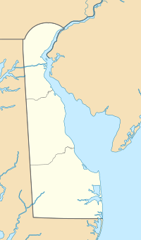
Location of Sowbridge Branch mouth
|
|
| Other name(s) | Tributary to Primehook Creek |
| Country | United States |
| State | Delaware |
| County | Sussex |
| Physical characteristics | |
| Main source | Gravelly Branch divide about 0.5 miles southeast of Ellendale, Delaware 50 ft (15 m) 38°47′56″N 075°24′09″W / 38.79889°N 75.40250°W |
| River mouth | Primehook Creek (Waples Pond) Waples Pond Acres, Delaware 4 ft (1.2 m) 38°49′15″N 075°19′02″W / 38.82083°N 75.31722°W |
| Length | 5.44 mi (8.75 km) |
| Basin features | |
| Progression | generally east |
| River system | Broadkill River |
| Basin size | 7.86 square miles (20.4 km2) |
| Tributaries |
|
| Waterbodies | Reynolds Pond |
| Bridges | Milton-Ellendale Highway, Holly Tree Road, Isaacs Road (DE 30), Cedar Creek Road |
Sowbridge Branch is a small river, about 5.44 mi (8.75 km) long, located in Sussex County, Delaware. It is a "tributary," which means it's a smaller stream or river that flows into a larger one. Sowbridge Branch flows into Primehook Creek.
Contents
About Sowbridge Branch
Sowbridge Branch is considered a "2nd order" tributary. This means it's a stream that forms when two "1st order" streams (the smallest kind) join together. It's an important part of the local water system in Delaware.
Where Does it Start and End?
Sowbridge Branch begins in an area called the Gravelly Branch divide. This is about 0.5 miles southeast of a town called Ellendale, Delaware.
From its start, the branch flows mostly towards the east. It continues its journey until it reaches Primehook Creek at a place known as Waples Pond.
What's in a Name?
Over time, Sowbridge Branch has been known by a couple of other names. These names are part of its history.
- Sawbridge Branch
- Sow Bridge Branch
These names are recorded by the Geographic Names Information System, which keeps track of place names.
The Land Around the Branch
The area of land that Sowbridge Branch drains is called its "watershed." This watershed covers about 7.86 square miles (20.4 km2). All the rain that falls in this area eventually flows into Sowbridge Branch.
On average, the watershed receives about 45.4 inches of rain each year. About 19% of the land in this watershed is covered by forests. These forests help keep the water clean and provide homes for wildlife.
 | George Robert Carruthers |
 | Patricia Bath |
 | Jan Ernst Matzeliger |
 | Alexander Miles |


