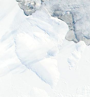
Spaatz Island facts for kids
 |
|
|
Location near the base of the Antarctic Peninsula
|
|
| Geography | |
|---|---|
| Location | Antarctica |
| Coordinates | 73°12′S 75°00′W / 73.200°S 75.000°W |
| Area | 4,100 km2 (1,600 sq mi) |
| Length | 80 km (50 mi) |
| Width | 40 km (25 mi) |
| Administration | |
| Administered under the Antarctic Treaty System | |
| Demographics | |
| Population | Uninhabited |
Spaatz Island is a large island covered in ice, located in Antarctica. It sits southwest of Alexander Island and west of the bottom part of the Antarctic Peninsula. It is also very close to the coast of Palmer Land, about 30 kilometers (19 miles) east of Smyley Island.
This island is quite big! It is 80 kilometers (50 miles) long and 40 kilometers (25 miles) wide. Its total area is about 4,100 square kilometers (1,600 square miles).
Discovery and Naming
The northern side of Spaatz Island forms part of the southern edge of Ronne Entrance. The rest of the island is surrounded by large ice shelves, which are floating sheets of ice connected to land. These ice shelves are part of Stange Sound and George VI Sound.
In December 1940, two explorers named Finn Ronne and Carl Eklund traveled along the north side of this area. They were part of the US Antarctic Service expedition (1939–1941).
Later, the island was photographed from the air and mapped for the first time. This happened during the Ronne Antarctic Research Expedition (RARE), which took place from 1947 to 1948. Finn Ronne also led this expedition.
Finn Ronne decided to name the island after General Carl Spaatz. General Spaatz was a very important person in the United States Air Force. He helped the RARE expedition by providing an airplane for their use.
See also
- Isla Spaatz para niños (Spaatz Island for kids in Spanish)
 | Emma Amos |
 | Edward Mitchell Bannister |
 | Larry D. Alexander |
 | Ernie Barnes |


