Smyley Island facts for kids
 |
|
|
Location in Antarctica
|
|
| Geography | |
|---|---|
| Location | Palmer Land, Antarctica |
| Coordinates | 72°55′S 78°0′W / 72.917°S 78.000°W |
| Length | 61 km (37.9 mi) |
| Width | 34 km (21.1 mi) |
| Administration | |
| Administered under the Antarctic Treaty System | |
| Demographics | |
| Population | Uninhabited |
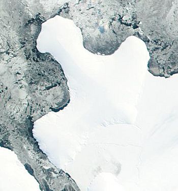
Smyley Island is an island in Antarctica. It is located off the Antarctic Peninsula. The island is about 61 kilometers (38 miles) long. It is also between 13 and 34 kilometers (8 to 21 miles) wide. Smyley Island is about 20 kilometers (12 miles) north of Case Island. It is connected to the Stange Ice Shelf. The Ronne Entrance separates it from Alexander Island. Smyley Island is one of 27 islands in Palmer Land, Antarctica.
Discovering Smyley Island
Smyley Island was first seen between 1939 and 1941. The United States Antarctic Service thought it was a part of mainland Antarctica. They called it Cape Smyley.
In 1968, a map from the United States Geological Survey showed it was an island. The island is named after Captain William H. Smyley. He was an American captain of a sealing ship called the Ohio. He sailed there in 1841–42.
Home to Emperor Penguins
A special area on Smyley Island is important for birds. This area is 497 hectares (about 1,228 acres) of fast ice. It is near Scorseby Head on the northern shore.
This spot is called an Important Bird Area (IBA) by BirdLife International. It is a breeding place for about 6,000 emperor penguins. Scientists found this out using satellite pictures from 2009.
See also
 In Spanish: Isla Smyley para niños
 | George Robert Carruthers |
 | Patricia Bath |
 | Jan Ernst Matzeliger |
 | Alexander Miles |


