Spencer State Forest facts for kids
Quick facts for kids Spencer State Forest |
|
|---|---|

Corridor 71
|
|
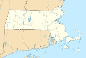
| Location | Spencer, Worcester, Massachusetts, United States |
| Area | 903 acres (365 ha) |
| Elevation | 679 ft (207 m) |
| Established | 1922 |
| Governing body | Massachusetts Department of Conservation and Recreation |
| Website | Spencer State Forest |
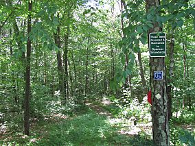
Spencer State Forest is a fun place in Spencer, Massachusetts. It's a state forest and a recreation area. The Massachusetts Department of Conservation and Recreation takes care of it. A long path called the Midstate Trail goes through the forest. This trail is 92 miles (148 km) long! The state also manages logging in some parts of the forest.
Contents
Exploring Spencer State Forest
Spencer State Forest is split into three separate areas. The most famous part is the Howe Pond area. This area used to belong to Elias Howe, who invented the sewing machine.
The Howe Pond Area
The Howe family from Spencer was known for inventing things. Elias Howe, Jr. invented the lockstitch sewing machine. The Howe Pond area was once called Howe State Park. It has a pond and a dam built by Elias Howe.
You can no longer swim in Howe Pond. There are no lifeguards there anymore. This area is great for picnics, with tables and outdoor grills. You can find it off Massachusetts Route 31 on Howe Pond Road.
Friends of the Forest
A group called the "Friends of Howe Park and Spencer State Forest" helps out. They are part of a bigger network of volunteers. These groups work to protect and improve state forests, parks, and trails in Massachusetts.
Trails and Outdoor Adventures
Spencer State Forest has many trails for you to explore.
The Midstate Trail
The Midstate Trail is a very long path, 92 miles (148 km) in total. It's marked with yellow triangles. The trail starts at the Massachusetts/Rhode Island border. It goes all the way north to New Hampshire.
In Spencer, the Midstate Trail passes through different parts of the state forest. It goes through private lands and conservation areas. You can find parking for the Midstate Trail along East Charlton and I Capen Roads. There is also parking in the Buck Hill areas.
The Midstate Trail connects many interesting spots. These include Moose Hill and Buck Hill Wildlife Management areas. It also links to Sugden Reservoir, Thompson and Browning Ponds. The trail even passes by Camp Marshall 4H Camp and Treasure Valley Boy Scout reservation.
Moose Hill and Buck Hill
North of Route 9, the Midstate Trail crosses Moose Hill. Here you'll find a pretty pond called Moose Hill levy pond. It was made in the 1960s to help control floods.
Skiing used to happen at Moose Hill in the 1960s. Skiers would ride up the hill on a hay wagon or truck. There was even a simple rope tow!
The northern part of Spencer State Forest is near Turkey Hill Brook. There's a simple shelter called a lean-to on Buck Hill. Campers can stay there overnight. Buck Hill is a drumlin (a type of hill) that is 1,014 feet (309 m) high. You can park off McCormick Road in Spencer to reach it.
The Depot Trail
The Depot Trail is a 2.5-mile walking path. It follows an old railroad bed. This trail connects to the Spencer State Forest trails. It runs from South Spencer Road to Chestnut Street.
Near the lower section of Howe Pond, the Depot Trail has benches. You can also go fishing or launch small boats there. Parking for this trail is next to the railroad overpass on South Spencer Road.
Snowmobile Trails
The Spencer Snowbirds Snowmobile Club was started in 1972. This private group takes care of snowmobile trails. These trails go through both public and private lands in the town. If you want to ride, you need a permit and membership. You can find more details on their website.
Water Resources in the Forest
Spencer State Forest has many beautiful water areas. These include Howe and Browning Ponds and Sugden Reservoir. Several brooks also flow through the area.
Turkey Hill Brook
Turkey Hill Brook flows from Paxton into Spencer. Dams were built along this brook long ago. They powered wire mills in the area. Today, only the dam that forms Thompson Pond remains. This brook joins the Seven Mile River.
Seven Mile River
The Seven Mile River starts in Rutland. It was dammed to create Browning Pond. This river meets Turkey Hill Brook. It then connects to the Quaboag River in East Brookfield. The river was an important landmark in the past.
Cranberry River
The Cranberry River flows from Charlton. It was dammed to form Cranberry Meadow Pond. It was dammed again to create Howe Pond. This river joins the Seven Mile River near Route 9.
Forest Landscape
The forest has many hills, creeks, and wet areas. The trees change from oak-hickory to northern hardwood types.
History of the Forest: The CCC Legacy
Howe State Park was created thanks to the Civilian Conservation Corps (CCC). This program started in 1933. It was during the Great Depression, a time when many people were out of work.
What was the CCC?
President Franklin D. Roosevelt started the CCC. It was also known as "Roosevelt's Tree Army." The CCC helped people by giving jobs to young men and veterans. This helped their families. The program also focused on improving parks and open spaces.
CCC in Massachusetts
From 1933 to 1942, the CCC worked in Massachusetts. About 100,000 men joined nearly 68 camps. They improved state parks and forests. The work they did still helps us enjoy these places today.
When the CCC started, Massachusetts state parks were new. The work of the CCC built the foundation for the park system we have now. Spencer State Forest was once cut-over land. It was hard to reach because there were no roads or facilities. The CCC built roads, trails, and recreational areas. They also planted trees. Today, the Howe Park area is not fully open.
 | Jackie Robinson |
 | Jack Johnson |
 | Althea Gibson |
 | Arthur Ashe |
 | Muhammad Ali |


