Sprague, Nebraska facts for kids
Quick facts for kids
Sprague, Nebraska
|
|
|---|---|
|
Village
|
|

Downtown Sprague: corner of Second and Market Streets
|
|

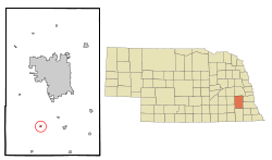
Location of Sprague, Nebraska
|
|
| Country | United States |
| State | Nebraska |
| County | Lancaster |
| Area | |
| • Total | 0.10 sq mi (0.26 km2) |
| • Land | 0.10 sq mi (0.26 km2) |
| • Water | 0.00 sq mi (0.00 km2) |
| Elevation | 1,289 ft (393 m) |
| Population
(2020)
|
|
| • Total | 136 |
| • Density | 1,346.53/sq mi (521.05/km2) |
| Time zone | UTC-6 (Central (CST)) |
| • Summer (DST) | UTC-5 (CDT) |
| ZIP code |
68438
|
| Area code(s) | 402 |
| FIPS code | 31-46380 |
| GNIS feature ID | 2399874 |
Sprague is a small village in Lancaster County, Nebraska, in the United States. It is part of the larger Lincoln metropolitan area. In 2020, the village had a population of 136 people.
Contents
History of Sprague
Early Settlements and Naming
Before Sprague existed, there was a place called Centerville. In 1865, Centerville even had a post office. However, it never grew into a lasting community.
Sprague was officially started in 1888. This happened when the Missouri Pacific Railroad built tracks through the area. The village was named after William Sprague and his wife, Amy. William Sprague was a local hero from the Civil War.
In 1894, another station called "Martell" was set up nearby by the Rock Island Railroad. But Martell never became an official village. Sprague, however, was officially incorporated in 1913. At that time, villages no longer needed 200 people to become official.
Fires and the Bluestem Lake
Sprague faced some tough times with fires. In 1912 and again in 1927, large fires broke out. These fires burned down many businesses in the village.
A big change came in 1963 with the building of the Bluestem Conservation Dam. This dam created a large lake called Bluestem Lake, which is about 325 acres. A conservation area was also made around the lake. This area covers 742 acres and is used for fun outdoor activities.
The lake brought more homes to the area, especially for people who were retired or wanted a vacation home. Even with these changes, Sprague and the surrounding area are still mostly rural, meaning they have a lot of farms and open land.
Geography of Sprague
Sprague is a small village. According to the United States Census Bureau, it covers about 0.10 square miles (0.26 square kilometers). All of this area is land, with no water.
Population Information
| Historical population | |||
|---|---|---|---|
| Census | Pop. | %± | |
| 1920 | 112 | — | |
| 1930 | 135 | 20.5% | |
| 1940 | 121 | −10.4% | |
| 1950 | 110 | −9.1% | |
| 1960 | 120 | 9.1% | |
| 1970 | 119 | −0.8% | |
| 1980 | 168 | 41.2% | |
| 1990 | 157 | −6.5% | |
| 2000 | 146 | −7.0% | |
| 2010 | 142 | −2.7% | |
| 2020 | 136 | −4.2% | |
| U.S. Decennial Census | |||
Sprague's Population in 2010
In 2010, there were 142 people living in Sprague. These people lived in 61 different homes. About 41 of these homes were families. The village had about 1420 people per square mile.
Most of the people in Sprague were White (97.2%). A small number were from other backgrounds. About 1.4% of the population was Hispanic or Latino.
Many homes (27.9%) had children under 18 living there. Most homes (57.4%) were married couples. The average home had 2.33 people, and the average family had 2.68 people.
The average age of people in Sprague was 39 years old. About 22.5% of residents were under 18. About 16.2% were 65 years old or older. The village had slightly more males (51.4%) than females (48.6%).
See also
- In Spanish: Sprague (Nebraska) para niños

