
Spring Prairie (community), Wisconsin facts for kids
Quick facts for kids
Spring Prairie, Wisconsin
|
|
|---|---|

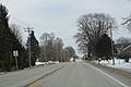
The intersection of Highways 11 and 120 in Spring Prairie
|
|

Spring Prairie (community), Wisconsin
Location in Wisconsin

Spring Prairie (community), Wisconsin
Location in the United States
|
|
| Country | |
| State | |
| County | Walworth |
| Elevation | 309 m (1,014 ft) |
| Time zone | UTC-6 (Central (CST)) |
| • Summer (DST) | UTC-5 (CDT) |
| Zip |
53177
|
| Area code(s) | 262 |
| GNIS feature ID | 1574692 |
Spring Prairie is a small place in Walworth County, Wisconsin, United States. It is also sometimes called Franklin. This community is not a city or a village with its own local government. Instead, it is part of the larger Town of Spring Prairie.
Where is Spring Prairie?
Spring Prairie is easy to find on a map. It is located where two important roads meet. These roads are Wisconsin Highway 11 and Wisconsin Highway 120.
The community is about 7.25 miles (11.67 kilometers) east of a town called Elkhorn. This makes it a quiet spot in the countryside.
What is an Unincorporated Community?
An unincorporated community like Spring Prairie does not have its own separate government. It is part of a larger area, in this case, the Town of Spring Prairie. This means that services like roads and schools are managed by the town or county. People living here still have a strong sense of community.
Images for kids
-
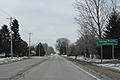
Looking east at Spring Prairie
-
Looking east at the sign for Spring Prairie on WIS11


