
St. John's International Airport facts for kids
Quick facts for kids
St. John's International Airport
|
|||||||||||||||||||
|---|---|---|---|---|---|---|---|---|---|---|---|---|---|---|---|---|---|---|---|
 |
|||||||||||||||||||
| Summary | |||||||||||||||||||
| Airport type | Public | ||||||||||||||||||
| Owner | Transport Canada | ||||||||||||||||||
| Operator | St. John's International Airport Authority Inc. | ||||||||||||||||||
| Serves | St. John's, Newfoundland and Labrador | ||||||||||||||||||
| Elevation AMSL | 461 ft / 141 m | ||||||||||||||||||
| Coordinates | 47°37′07″N 052°45′09″W / 47.61861°N 52.75250°W | ||||||||||||||||||
| Website | www.stjohnsairport.com/ | ||||||||||||||||||
| Runway | |||||||||||||||||||
|
|||||||||||||||||||
| Statistics (2007) | |||||||||||||||||||
|
|||||||||||||||||||
|
Source: Canada Flight Supplement
Statistics from Transport Canada. |
|||||||||||||||||||
St. John's International Airport (YYT) is a busy airport in Newfoundland and Labrador, Canada. It is located about 5.6 kilometers (3.5 miles) northwest of the city of St. John's. This airport is a key part of Canada's airport system. It is managed by the St. John's International Airport Authority Inc.
Contents
About St. John's Airport
St. John's International Airport is an important place for travel. It connects the province of Newfoundland and Labrador to other parts of Canada and the world. The airport helps people visit, and it also helps businesses.
Who Owns and Runs It?
The airport is owned by Transport Canada, which is a part of the Canadian government. It is operated by a group called the St. John's International Airport Authority Inc. This group makes sure the airport runs smoothly every day.
Airport Location and Size
The airport is located on the island of Newfoundland. It sits at an elevation of 141 meters (461 feet) above sea level. This means it is quite high up!
Runways at the Airport
Airports need runways for planes to take off and land safely. St. John's International Airport has three main runways.
- Runway 02/20: This runway is 1,533 meters (5,028 feet) long.
- Runway 11/29: This is the longest runway, at 2,591 meters (8,502 feet) long.
- Runway 16/34: This runway is 2,135 meters (7,005 feet) long.
All the runways at St. John's Airport are made of Asphalt. This material is strong and durable for aircraft.
Busy Skies: Aircraft Movements
In 2007, St. John's International Airport had 39,708 "aircraft movements." This number tells us how many times planes took off or landed at the airport. It shows how busy the airport is with flights.
Images for kids
-
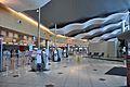
Check-in areas in St. John's airport.
-

Provincial Airlines Dash-8 Sunset landing
.jpg)

See also
 In Spanish: Aeropuerto Internacional de San Juan de Terranova para niños
