St. Patricks Channel facts for kids
Quick facts for kids St. Patricks Channel |
|
|---|---|
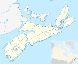
| Location | Cape Breton Island, Nova Scotia |
| Coordinates | 46°03′50″N 60°51′02″W / 46.06389°N 60.85056°W |
| Type | Channel |
| Part of | Bras d'Or Lake |
| Ocean/sea sources | Gulf of Saint Lawrence, Atlantic ocean |
| Basin countries | Canada |
| Max. length | 11.8 nautical miles (21.9 km; 13.6 mi) |
| Max. width | 2 nautical miles (3.7 km; 2.3 mi) |
St. Patricks Channel is a part of the Bras d'Or Lake system. It is located on Cape Breton Island in the Canadian province of Nova Scotia. This channel is entirely within Victoria County.
Contents
What is St. Patricks Channel?
St. Patricks Channel stretches from the village of Baddeck to Little Narrows. It flows generally from northeast to southwest. At Little Narrows, it connects with Whycocomagh Bay. The land around the channel is mostly covered with thick forests. The shores are often rocky, with unique white gypsum rocks. There are also natural barriers of sand and gravel called barrachois beaches.
Since the channel is part of the Bras d'Or Lake, its water is a mix of fresh and salt water. This is because the Bras d'Or Lake is like a long, narrow bay (a fiord). It connects to the North Atlantic through two smaller channels.
How the Channel Was Formed
Long ago, during the last ice age, glaciers covered the Bras d'Or Lakes area. When the ice melted, the lakes were filled with fresh water. About 6,350 years ago, the ocean level rose. This connected the lakes to the sea. The ocean water came in quite quickly at first. Because of this, the lakes have some of the best-preserved ancient shorelines. These old shores are now 25 meters (about 82 feet) below the current sea level. You can even find old river paths underwater in St. Patricks Channel.
A Look at History
By the year 1829, people had settled along the shores and rivers of St. Patricks Channel. Most of these settlers were Scottish immigrants. Ships from Great Britain would visit the channel. They came to load wood to take back to their country.
Boating and Fun on the Water
If you love boating, St. Patricks Channel is a great spot! The Cruising Club of America suggests the Washabuck River as a favorite place to anchor. It's a popular choice for people cruising in their boats.
Local Industry: Gypsum Mining
Near Little Narrows, there's a large gypsum mine called CGC Little Narrows. It's run by Little Narrows Gypsum, which is part of United States Gypsum. This mine has been digging up gypsum since 1935. Gypsum is a soft mineral used to make things like drywall.
The company ships about one million tons of gypsum each year. This raw gypsum goes by boat to places in the United States, like Baltimore, Maryland, and Florida. The loading area is closed from January to March. So, about 30 ships visit the channel from April to December to pick up the gypsum. In 2004, the mine produced over a million tons of gypsum. The company provides jobs for 51 people.
The Name's Story
The name "St. Patricks Channel" has been used for a long time. It appeared in writings as early as 1829. You can also find it on maps from 1855. The official spelling, "St. Patricks Channel" (without an apostrophe), was made official on August 14, 1962.
 | Sharif Bey |
 | Hale Woodruff |
 | Richmond Barthé |
 | Purvis Young |


