Stearleyville, Indiana facts for kids
Quick facts for kids
Stearleyville
|
|
|---|---|
| Country | United States |
| State | Indiana |
| County | Clay |
| Township | Jackson |
| Elevation | 650 ft (200 m) |
| ZIP code |
47840
|
| FIPS code | 18-72854 |
| GNIS feature ID | 444104 |
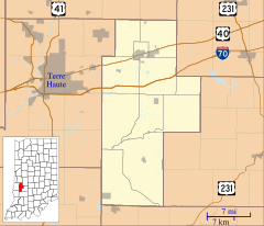
Stearleyville is a small, unincorporated community located in Jackson Township, Clay County, Indiana. An unincorporated community is a place that doesn't have its own local government. It is part of a larger county or township.
Contents
A Look Back at Stearleyville
How Stearleyville Started
The area known as Stearleyville was founded by a man named George Stearley. His parents, Johann (John) and Rosanna Burkhardt Stierle, were immigrants from Pfuhl, Neu-Ulm, Bavaria, which is in Germany. They moved to Clay County in 1856.
George Stearley himself became an important person in the area. He even served as the sheriff of Clay County. George had six brothers: William, John, Fred, Charles, and Tobias. He also had one sister named Rose.
Life in Early Stearleyville
When Stearleyville was first developing, it had several important buildings. There was a railroad depot, which is like a train station. There was also a store, a church, and several houses.
A blacksmith shop was also a key part of the community. George Stearley II, who was George Stearley's son, started this shop. Later, his brother Roy took over running it.
A post office was opened in Stearleyville in 1893. This allowed people to send and receive mail right in their community. However, the post office closed nine years later, in 1902.
The Stearley Family's Impact
By the year 1900, many of George Stearley's descendants lived in the area. There were so many members of the Stearley family that people had a special saying. They would joke that "Clay County was made up of Stearleys and Ragweeds." This just meant that a huge number of people in the county were part of the Stearley family!
Stearleyville Today
Today, Stearleyville is considered part of the Terre Haute Metropolitan Statistical Area. This means it is included in the larger urban area around the city of Terre Haute.
Where is Stearleyville?
Stearleyville is located at the coordinates 39°26′42″N 87°03′41″W / 39.44500°N 87.06139°W. This helps pinpoint its exact spot on a map.
 | John T. Biggers |
 | Thomas Blackshear |
 | Mark Bradford |
 | Beverly Buchanan |


