
Steinhausen, Switzerland facts for kids
Quick facts for kids
Steinhausen
|
||
|---|---|---|
 |
||
|
||

Steinhausen
Location in Switzerland

Steinhausen
Location in Canton of Zug
|
||
| Country | Switzerland | |
| Canton | Zug | |
| District | n.a. | |
| Area | ||
| • Total | 5.04 km2 (1.95 sq mi) | |
| Elevation | 427 m (1,401 ft) | |
| Population
(Dec 2020 )
|
||
| • Total | 10,198 | |
| • Density | 2,023.4/km2 (5,241/sq mi) | |
| Postal code |
6312
|
|
| Surrounded by | Baar, Cham, Kappel am Albis (ZH), Knonau (ZH), Zug | |

Steinhausen is a city located in the canton of Zug in Switzerland. It is a vibrant community with a rich history and beautiful surroundings.
Contents
History of Steinhausen
Steinhausen was first mentioned in old documents way back in 1173. At that time, it was called Steinhusin. This shows that people have lived here for a very long time!
Geography and Nature

Steinhausen covers an area of about 5 square kilometers (about 2 square miles). A big part of this land, about half of it, is used for farming. This means there are lots of fields and open spaces. About 15% of the area is covered by forests, which are great for exploring.
The city itself, with its buildings and roads, takes up about a third of the land. A small part (just over 1%) includes rivers or other natural areas that are not used for farming or building.
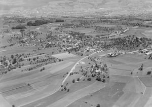
Steinhausen is located on the northwest side of the Lorze river's flat area. The city includes the main village of Steinhausen and two smaller communities called Bann and Erli.
People and Community
Steinhausen is home to many people. As of the latest information, a good number of the people living here are from other countries. Over the past ten years, the number of people living in Steinhausen has grown quite a bit, showing it's a popular place to live.
Most people in Steinhausen speak German. However, you will also hear other languages like Serbo-Croatian and Italian, which makes the community very diverse!
Politics and Elections
In the 2007 national election, the most popular political party in Steinhausen was the SVP. Other popular parties included the CVP, the FDP, and the Green Party. These parties represent different ideas about how the country should be run.
Education and Jobs
Many adults in Steinhausen have completed a good level of education. This includes finishing high school or going on to higher education like university or a special college.
The city has a low unemployment rate, which means most people who want to work can find jobs. Many people work in different types of jobs:
- Some work in the primary sector, which means jobs related to farming.
- Many work in the secondary sector, which includes jobs in factories and making things.
- The largest number of people work in the tertiary sector, which involves services like shops, offices, and healthcare.
Historical Population
Here's how the number of people living in Steinhausen has changed over many years:
| year | population |
|---|---|
| 1771 | 389 |
| 1850 | 490 |
| 1900 | 443 |
| 1910 | 470 |
| 1950 | 1,078 |
| 1970 | 4,138 |
| 1990 | 7,207 |
| 2000 | 8,801 |
Getting Around: Transport
Steinhausen has its own train station, Steinhausen railway station. It is a stop on the Zürich S-Bahn line S5. You can get to Zürich Hauptbahnhof, a big train station in Zurich, in about 43 minutes from here. Another train station, Steinhausen Rigiblick railway station, was opened in 2012, making it even easier to travel around.
Famous People from Steinhausen
Several interesting people have connections to Steinhausen:
- Max Huwyler (born 1931) is a Swiss writer who lives in Steinhausen.
- Josef Bisig (born 1952 in Steinhausen) is a Roman Catholic priest who helped start a religious group.
- Céline Schärer (born 1990) is a professional Swiss triathlete who lives in Steinhausen.
- Nina Betschart (born 1995 in Steinhausen) is a professional Swiss beach volleyball player.
See also
 In Spanish: Steinhausen para niños
