Stephens Island Lighthouse facts for kids
 |
|
|
|
|
| Location | Northeast of the much larger D'Urville Island
South Island New Zealand |
|---|---|
| Coordinates | 40°24′S 174°00′E / 40.40°S 174.00°E |
| Year first lit | 1894 |
| Automated | 1989 |
| Construction | White cast iron tower |
| Height | 15 metres (49 ft) |
| Focal height | 183 metres (600 ft) |
| Range | 18 nautical miles (33 km; 21 mi) |
| Characteristic | Flashes white once every six seconds |
| Admiralty number | K4236 |
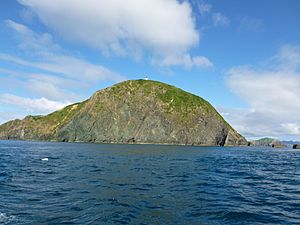
The Stephens Island / Takapourewa Lighthouse is a super powerful light in New Zealand. It stands high up on Stephens Island. This lighthouse helps guide ships safely through Cook Strait and Tasman Bay / Te Tai-o-Aorere. These waters are at the top of New Zealand's South Island / Te Wai Pounamu.
The light flashes white once every six seconds. It shines from a tall, white tower made of cast iron. The lighthouse is controlled from far away by Maritime New Zealand in Wellington. It first lit up on January 29, 1894. It became automatic on March 31, 1989. This made it one of the last lighthouses in New Zealand to be automated.
You need special permission to visit the lighthouse and its tower. This is because it is part of the Stephens Island Nature Reserve. The Department of Conservation looks after this special place. Today, the island is home to amazing creatures like tuatara. No people live there now. There is even a fun story about a cat named Tibbles.
Discovering Stephens Island
The Māori name for the island is Takapourewa. This name comes from the takapou trees that once covered the island. These trees, also known as matipo, grew right down to the water. It looked like the island was floating in the sea. The Māori word for float is rewa. So, the name means "floating takapou trees."
In 1770, Captain James Cook sailed past the island. He named it after Sir Philip Stephens. Sir Philip was a leader in the British Navy.
Building a Lighthouse on a High Island
As New Zealand grew in the 1850s, people saw the need for lighthouses. Stephens Island was a perfect spot for one. It was first suggested in 1854. The idea came up again in 1888 after a ship crashed nearby. Building the lighthouse was very hard. The island is far away and the sea around it is rough. The land is also very steep.
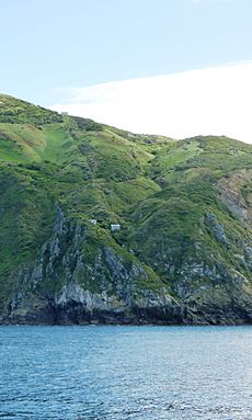
This lighthouse is the highest above sea level in all of New Zealand. Before building could start, a team arrived in 1891. They built a boat landing and a special tramway. This tramway went straight up the steep cliffs.
The parts for the light came from Scotland and France. The lighthouse cost a lot of money, about £9,349. This was twice the cost of many other lighthouses in New Zealand. When it first opened, it was the brightest lighthouse in the country. It used five paraffin lamps.
Island Life and Nature
Native māpou (red matipo) trees were cleared to make way for the lighthouse. Sheep and cattle were also brought to the island. Sadly, this clearing and the arrival of wild cats harmed the island's birds. Birds like the tui, bellbird, and saddleback became much rarer.
However, when a nature collector named Edward Lukins visited, he found many animals. He recorded 31 types of birds. He also found two kinds of land snails and four types of lizards.
Life for the lighthouse keepers and their families was tough. They had to climb a steep path from their boat to their homes. Besides keeping the light shining, they also helped protect wildlife. During World War II, they watched the coast for enemy ships. Being so isolated meant getting sick was a big risk. For example, in 1909, a doctor and nurse had to be sent urgently to stop an outbreak of scarlet fever.
On a happier note, the lighthouse appeared on a four pence postage stamp in 1947. At one time, three keepers lived there. There was even a small school for their children. In the mid-1960s, Jeanette Aplin and her family lived on the island for six years. She wrote a book about her experiences. It tells about life in a lighthouse community and enjoying being away from busy society.
 | Jessica Watkins |
 | Robert Henry Lawrence Jr. |
 | Mae Jemison |
 | Sian Proctor |
 | Guion Bluford |


