Stockport, Ohio facts for kids
Quick facts for kids
Stockport, Ohio
|
|
|---|---|
|
Village
|
|

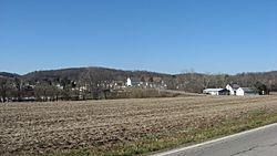
Overview from the east
|
|

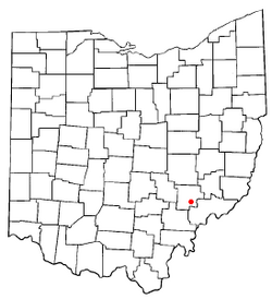
Location of Stockport, Ohio
|
|

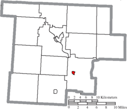
Location of Stockport in Morgan County
|
|
| Country | United States |
| State | Ohio |
| County | Morgan |
| Area | |
| • Total | 0.33 sq mi (0.85 km2) |
| • Land | 0.33 sq mi (0.85 km2) |
| • Water | 0.00 sq mi (0.00 km2) |
| Elevation | 699 ft (213 m) |
| Population
(2020)
|
|
| • Total | 483 |
| • Density | 1,468.09/sq mi (567.53/km2) |
| Time zone | UTC-5 (Eastern (EST)) |
| • Summer (DST) | UTC-4 (EDT) |
| ZIP code |
43787
|
| Area code(s) | 740 |
| FIPS code | 39-74748 |
| GNIS feature ID | 2399904 |
| Website | http://stockportohio.weebly.com/ |
Stockport is a small village located in Morgan County, Ohio, United States. It sits right next to the Muskingum River. In 2020, about 483 people lived there.
Contents
History of Stockport
The village of Stockport gets its name from a town called Stockport in England. This area was once part of a large piece of land known as the "Donation Tract" in the "Northwest Territory."
Early Land Grants
In 1792, the United States Congress allowed grants of 100 acres of land to any male aged 18 or older who would settle in this area. This was done to encourage people to move there quickly. It also helped protect lands owned by the Ohio Company of Associates from conflicts with Native American tribes.
Post Office Established
The Stockport post office was officially opened in 1838. This was an important step in developing the community and connecting it with other places.
Geography of Stockport
Stockport is located in Ohio at coordinates 39.549361 degrees North and 81.794250 degrees West.
Area and Location
According to the United States Census Bureau, the village covers a total area of about 0.33 square miles (0.85 square kilometers). All of this area is land. Stockport is also found where two state roads, Route 266 and Route 376, meet.
Population and People
Stockport has seen its population change over the years. Here's a quick look at how many people have lived there at different times:
- 1870: 289 people
- 1880: 335 people
- 1890: 416 people
- 1900: 376 people
- 1910: 438 people
- 1920: 455 people
- 1930: 458 people
- 1940: 422 people
- 1950: 404 people
- 1960: 458 people
- 1970: 471 people
- 1980: 558 people
- 1990: 462 people
- 2000: 540 people
- 2010: 503 people
- 2020: 483 people
Life in Stockport in 2010
Based on the census from 2010, there were 503 people living in Stockport. These people lived in 195 different homes, and 140 of these were families.
Population Details
The village had about 1,524 people per square mile (588 people per square kilometer). Most of the people, about 91.7%, were White. About 3.0% were African American, and 5.2% were from two or more racial backgrounds. A small number, 0.6%, were of Hispanic or Latino origin.
Households and Families
Out of the 195 homes, about 34.9% had children under 18 living there. Nearly half, 48.2%, were married couples living together. About 18.5% of homes had a female head of household without a husband present. The average home had about 2.58 people, and the average family had about 3.01 people.
Age Groups
The average age of people in the village was 35.1 years old.
- About 26.6% of residents were under 18.
- About 10.7% were between 18 and 24.
- About 23% were between 25 and 44.
- About 26.8% were between 45 and 64.
- About 13.3% were 65 years old or older.
There were slightly more females (53.3%) than males (46.7%) in the village.
See also
 In Spanish: Stockport (Ohio) para niños
 | Victor J. Glover |
 | Yvonne Cagle |
 | Jeanette Epps |
 | Bernard A. Harris Jr. |

