Muskingum River facts for kids
Quick facts for kids Muskingum River |
|
|---|---|

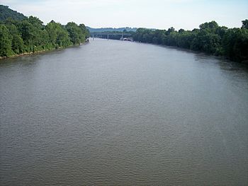
The Muskingum River near its mouth in Marietta, Ohio
|
|
| Country | United States |
| Physical characteristics | |
| Main source | Confluence of the Tuscarawas and Walhonding Rivers |
| River mouth | Ohio River at Marietta, Ohio 582 ft (177 m) |
| Length | 111 mi (179 km) |
| Basin features | |
| Basin size | 8,051 sq mi (20,850 km2) |
The Muskingum River is a river in southeastern Ohio, United States. It flows for about 111 miles (179 kilometers) and is an important branch of the Ohio River. In the 1800s, it was a busy route for boats carrying goods. Today, you can still travel on much of the river thanks to special locks and dams. The river's name comes from the Shawnee language.
Contents
River's Journey
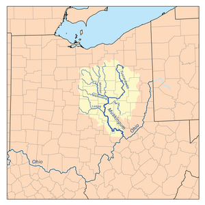
The Muskingum River starts in Coshocton, Ohio. This is where two other rivers, the Walhonding River and the Tuscarawas River, join together.
The river then winds its way south. It flows past towns like Zanesville, Ohio, McConnelsville, Ohio, and Beverly, Ohio. Finally, it meets the Ohio River at Marietta, Ohio.
Along its path, the Muskingum River collects water from several smaller streams. These include Wills Creek, Wakatomika Creek, the Licking River, Moxahala Creek, and Wolf Creek.
River's Past
What's in a Name?
The name Muskingum comes from the Shawnee language. It means 'swampy ground'. Some people also thought it meant 'elk's eye'. This was because many elk used to live along the riverbanks.
Early Explorers and Settlements
In 1749, a French explorer named Pierre Joseph Céloron de Blainville buried a lead plate. This was to claim the area for France.
Later, in 1751, a famous explorer named Christopher Gist visited the Muskingum River. He stayed for a month in a Native American town called Muskingum. This town was located where Coshocton, Ohio is today.
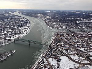
Marietta, Ohio was the first permanent American settlement in the Northwest Territory. It was founded in 1788 where the Muskingum River meets the Ohio River. An event called the Big Bottom massacre happened along the river in 1791.
River as a Trade Route
Zanesville, Ohio was settled in 1799. It was built where a path called Zane's Trace crossed the Muskingum River.
In the mid-1800s, the Muskingum River was very important for shipping goods. Special dams and locks were built. These helped control the water level so boats could travel easily.
Over time, people started using roads and trains more. The river's locks fell into disrepair by the 1920s.
Modern River Use
Since the 1960s, many of the locks have been repaired. Now, people can use the river for fun activities like boating. The Muskingum waterway is special because its locks are still operated by hand. This system has been named a national Historic Civil Engineering Landmark.
In 2006, the river was named "An Ohio Water Trail." This means it's a great place for canoes and kayaks.
The Underground Railroad
From about 1812 to 1861, the Muskingum River played a role in the Underground Railroad. This was a secret network that helped enslaved people escape to freedom. Many people used the river as a route to travel north to Lake Erie and Canada.
Caring for the River
There are groups that work to protect the Muskingum River. The Friends of the Lower Muskingum River is one such group. They help protect the river and the land next to it. The Muskingum Watershed Conservancy District also works to control floods on the river.
Other Names for the River
The Muskingum River has been known by a few other names over time:
- Big Muskingum River
- Elk River
- Mouskindom River
- Mushkingum River
- Muskingham River
- Riviere Chiagnez
See also
 In Spanish: Río Muskingum para niños
 | Janet Taylor Pickett |
 | Synthia Saint James |
 | Howardena Pindell |
 | Faith Ringgold |


