Licking River (Ohio) facts for kids
Quick facts for kids Licking River |
|
|---|---|

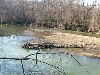
The Licking River in Black Hand Gorge State Nature Preserve
|
|
| Country | US |
| Physical characteristics | |
| Main source | Newark in Licking County 800 ft (240 m) |
| River mouth | Muskingum River in Zanesville 680 ft (210 m) |
| Basin features | |
| Basin size | 779 sq mi (2,020 km2) |
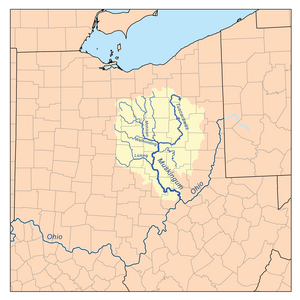
The Licking River is a river located in central Ohio, United States. It is about 40 miles (65 kilometers) long. This river flows into the Muskingum River. From there, its waters travel into the Ohio River and then into the mighty Mississippi River. This means the Licking River is part of the huge watershed of the Mississippi River.
Contents
Where Does the Licking River Flow?
The Licking River starts in Newark, which is in Licking County. It forms when two main parts, the North Fork and the South Fork, join together. Many smaller streams also feed into it.
North Fork Licking River
The North Fork is about 35 miles (55 kilometers) long. It begins in southwestern Morrow County. First, it flows mostly east and southeast through Knox County, passing by Centerburg. Then it enters Licking County. Near Utica, it turns south and flows past St. Louisville. Along its way, the North Fork collects water from other streams like the Otter Fork, Lake Fork, and Clear Fork.
South Fork Licking River
The South Fork is about 30 miles (50 kilometers) long. It starts in the southwestern part of Licking County. It flows southeast past towns like Pataskala and Kirkersville. For a short distance, it goes into Fairfield County. Then it turns northeast and flows back into Licking County, passing by Heath.
Journey to the Muskingum River
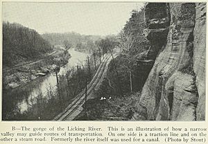
After the North and South Forks meet in Newark, the Licking River flows east. It passes through the beautiful Black Hand Gorge State Nature Preserve. The river then enters Muskingum County, where it turns southeast. Finally, the Licking River joins the Muskingum River in Zanesville. At this meeting point, there is a famous Y-shaped bridge that crosses both rivers.
Dillon Lake
Before reaching Zanesville, the Licking River forms a large body of water called Dillon Lake. This lake was created by a dam built by the U.S. Army Corps of Engineers. There is also a state park located along the shores of Dillon Lake, offering fun outdoor activities.
How Much Water Flows?
The amount of water flowing in a river is called its discharge or flow rate. Scientists measure this to understand how much water is moving through the river at different times. For example, the North Fork of the Licking River near Newark has an average flow of about 324 cubic feet per second. The South Fork near Heath averages about 264 cubic feet per second. Near its mouth in Zanesville, the Licking River's estimated average flow is around 977 cubic feet per second. This shows how the river grows as more streams join it.
Johnny Appleseed and the River
Did you know that the famous American pioneer, Jonathan Chapman, also known as Johnny Appleseed, had a connection to the Licking River? In 1801, he planted one of his very first apple orchards near what was then called Licking Creek. He brought apple seeds all the way from Pennsylvania cider presses into the Ohio Territory. This story was shared in a magazine article from 1871. Johnny Appleseed spent his life traveling and planting apple trees, helping settlers have fruit in the new lands.
Other Names for the River
Over time, the Licking River has been known by a few different names. These include:
- Licking Creek
- Nepepenime Sepe
- Pataskala Creek
- Pataskala River
- Salt Lick Creek
 | Kyle Baker |
 | Joseph Yoakum |
 | Laura Wheeler Waring |
 | Henry Ossawa Tanner |


