Utica, Ohio facts for kids
Quick facts for kids
Utica, Ohio
|
|
|---|---|
|
Village
|
|

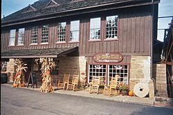
Ye Olde Mill
|
|
| Motto(s):
"What a great place to call home."
|
|

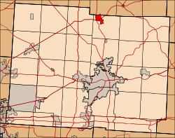
Location of Utica, Ohio
|
|

Location in Licking County (highlighted) and Knox County
|
|
| Country | United States |
| State | Ohio |
| Counties | Licking, Knox |
| Area | |
| • Total | 1.76 sq mi (4.55 km2) |
| • Land | 1.75 sq mi (4.52 km2) |
| • Water | 0.01 sq mi (0.03 km2) |
| Elevation | 1,056 ft (322 m) |
| Population
(2020)
|
|
| • Total | 2,064 |
| • Density | 1,182.81/sq mi (456.58/km2) |
| Time zone | UTC-5 (Eastern (EST)) |
| • Summer (DST) | UTC-4 (EDT) |
| ZIP code |
43080
|
| Area code(s) | 740 |
| FIPS code | 39-79114 |
| GNIS feature ID | 2400034 |
Utica is a small village located in Ohio, a state in the United States. It sits along the North Fork of the Licking River. Utica is unique because it's in two different counties: Knox and Licking counties. In 2020, about 2,064 people lived there.
Contents
A Look Back in Time: Utica's History
Utica was first planned out in 1815. It was given its name after another city, Utica, New York.
Glass Making in Utica
At the start of the 1900s, Utica was a very important place for making hand-blown window glass. This was because the area had a lot of natural silica and natural gas, which are both needed to make glass.
Workers would gather hot, melted glass into a ball. Then, they would blow it into a long tube. The ends of the tube were cut off. The tube was heated again, cut open, and flattened to make window glass. These glass companies closed down after the stock market crash in 1929. New ways of making glass also came along.
Utica and the Underground Railroad
Before the American Civil War, Utica was a key stop on the Underground Railroad. This was a secret network that helped enslaved people find freedom.
Where is Utica?
Utica covers a total area of about 1.71 square miles (4.43 square kilometers). Most of this area, about 1.69 square miles (4.38 square kilometers), is land. A small part, about 0.02 square miles (0.05 square kilometers), is water.
Who Lives in Utica?
| Historical population | |||
|---|---|---|---|
| Census | Pop. | %± | |
| 1830 | 194 | — | |
| 1840 | 355 | 83.0% | |
| 1870 | 384 | — | |
| 1880 | 702 | 82.8% | |
| 1890 | 763 | 8.7% | |
| 1900 | 826 | 8.3% | |
| 1910 | 1,729 | 109.3% | |
| 1920 | 1,658 | −4.1% | |
| 1930 | 1,394 | −15.9% | |
| 1940 | 1,376 | −1.3% | |
| 1950 | 1,510 | 9.7% | |
| 1960 | 1,854 | 22.8% | |
| 1970 | 1,977 | 6.6% | |
| 1980 | 2,238 | 13.2% | |
| 1990 | 1,997 | −10.8% | |
| 2000 | 2,130 | 6.7% | |
| 2010 | 2,132 | 0.1% | |
| 2020 | 2,064 | −3.2% | |
| U.S. Decennial Census | |||
In 2010, about 2,132 people lived in Utica. There were 841 households, which are groups of people living together. The village had about 1,261 people per square mile.
Most people in Utica were White (97.7%). A small number were African American (0.5%), Native American (0.1%), or Asian (0.2%). About 0.9% of the population was Hispanic or Latino.
Many households (34.6%) had children under 18 living with them. About 46.1% were married couples. The average household had 2.50 people. The average family had 3.04 people.
The average age of people in Utica was 37.4 years old. About 27.1% of residents were under 18. About 15.8% were 65 years or older.
Learning in Utica
The North Fork Local Schools manages the schools in Utica. This includes two elementary schools, one middle school, and Utica High School.
Utica also has a public library. It is part of the Licking County Library System.
Famous People from Utica
- Todd Londot: A professional football player who played for the New York Giants.
- Patt Morrison: A well-known author.
See also
 In Spanish: Utica (Ohio) para niños
 | Bayard Rustin |
 | Jeannette Carter |
 | Jeremiah A. Brown |

