Licking County, Ohio facts for kids
Quick facts for kids
Licking County
|
|||
|---|---|---|---|
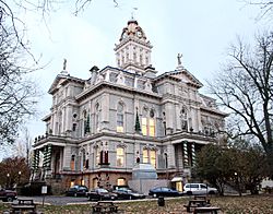
Licking County Courthouse
|
|||
|
|||
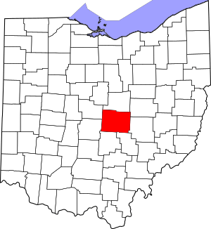
Location within the U.S. state of Ohio
|
|||
 Ohio's location within the U.S. |
|||
| Country | |||
| State | |||
| Founded | March 1, 1808 | ||
| Seat | Newark | ||
| Largest city | Newark | ||
| Area | |||
| • Total | 687 sq mi (1,780 km2) | ||
| • Land | 683 sq mi (1,770 km2) | ||
| • Water | 5.0 sq mi (13 km2) 0.7%% | ||
| Population
(2020)
|
|||
| • Total | 178,519 | ||
| • Estimate
(2021)
|
180,401 |
||
| • Density | 259.85/sq mi (100.33/km2) | ||
| Time zone | UTC−5 (Eastern) | ||
| • Summer (DST) | UTC−4 (EDT) | ||
| Congressional district | 12th | ||
Licking County is a place in the middle of Ohio, a state in the United States. In 2020, about 178,519 people lived there. The main town, or county seat, is Newark. Licking County was created on January 30, 1808. It was formed from parts of Fairfield County.
The county gets its name from the Licking River. People think the river was named after "salt licks" in the area. Salt licks are places where animals go to lick salt from the ground. Another idea is that the name comes from an old Delaware word, W'li/'ik'/nk. This word means "where the flood waters recede."
Licking County is part of the larger Columbus, Ohio, area.
Contents
Exploring Licking County's Land
Licking County covers a total area of about 687 square miles. Most of this is land, about 683 square miles. Only a small part, about 5 square miles, is water. This makes Licking County the third-largest county in Ohio by land size.
Neighboring Counties
Licking County shares its borders with several other counties:
- Knox County (to the north)
- Coshocton County (to the northeast)
- Muskingum County (to the east)
- Perry County (to the southeast)
- Fairfield County (to the southwest)
- Franklin County (to the west)
- Delaware County (to the northwest)
Main Roads and Highways
Many important roads and highways run through Licking County. These roads help people travel easily around the county and to other parts of Ohio.
 I-70
I-70 US 40
US 40 US 62
US 62 SR 13
SR 13 SR 16
SR 16 SR 37
SR 37 SR 79
SR 79 SR 146
 SR 161
 SR 586
 SR 657
 SR 661
People of Licking County
| Historical population | |||
|---|---|---|---|
| Census | Pop. | %± | |
| 1810 | 3,852 | — | |
| 1820 | 11,861 | 207.9% | |
| 1830 | 20,869 | 75.9% | |
| 1840 | 35,096 | 68.2% | |
| 1850 | 38,846 | 10.7% | |
| 1860 | 37,011 | −4.7% | |
| 1870 | 35,756 | −3.4% | |
| 1880 | 40,450 | 13.1% | |
| 1890 | 43,279 | 7.0% | |
| 1900 | 47,070 | 8.8% | |
| 1910 | 55,590 | 18.1% | |
| 1920 | 56,426 | 1.5% | |
| 1930 | 59,962 | 6.3% | |
| 1940 | 62,279 | 3.9% | |
| 1950 | 70,645 | 13.4% | |
| 1960 | 90,242 | 27.7% | |
| 1970 | 107,799 | 19.5% | |
| 1980 | 120,981 | 12.2% | |
| 1990 | 128,300 | 6.0% | |
| 2000 | 145,491 | 13.4% | |
| 2010 | 166,492 | 14.4% | |
| 2020 | 178,519 | 7.2% | |
| 2021 (est.) | 180,401 | 8.4% | |
| U.S. Decennial Census 1790-1960 1900-1990 1990-2000 2010-2020 |
|||
In 2010, there were about 166,492 people living in Licking County. Most people, about 93.2%, were white. About 3.4% were Black or African American. Other groups included Asian people (0.7%) and American Indian people (0.3%). About 1.4% of the population was of Hispanic or Latino background.
The average age of people in Licking County was about 39.1 years old. Many families lived in the county. About 34.2% of homes had children under 18 living there. The average household had about 2.55 people.
Jobs and Businesses in Licking County
Since Licking County started in 1808, businesses and industries have been very important. They provide jobs, help people earn money, and make the local economy grow. Key industries include making things (manufacturing), buying and selling goods (retail and wholesale trade), healthcare, and places to stay and eat (accommodation and food services).
Making Things: Manufacturing
Manufacturing is one of the biggest job areas in Licking County. Large companies like Invenergy, Armstrong World Industries, Intel, and Atkore have built factories here. These factories offer many different types of jobs. They also help the county's economy grow.
In the past, other big manufacturing companies like Longaberger and Fyrepel were also here. But they closed down, showing how competitive business can be. The glass-making industry has been important since the late 1800s. It grew in Newark because of natural gas, sand, and available workers.
Farming: Agriculture
Farming has always been a key part of Licking County. It helps people earn a living by growing crops and raising animals. Farmers grow things like corn and wheat. They also raise animals like cattle and goats.
Charles Metz and Brothers Meat Market in Newark is a well-known local farm business. It provides meat to butchers and markets nearby. Weiant Greenhouses used to grow lettuce in a huge greenhouse. It was one of Ohio's largest, supplying vegetables to three states. Sadly, it closed after a big storm in 1978. Today, farmers have better tools and products. But they still face challenges like rising costs and lower payouts for their goods.
Helping People: Services
The service industry provides jobs for more than 30% of the workers in Licking County. This includes many different types of services. For example, there are places to live, restaurants, and entertainment.
Two major types of services are education and food services. Schools and colleges like Denison University, Newark City Schools, and Columbus State Community College are here. Popular places to eat include Elliot's Wood Fired Kitchen & Tap and Three Tigers Brewing Co.
New Businesses and Growth
Licking County continues to see a lot of growth in many industries. Manufacturing, retail trade, and healthcare are the top three job providers.
From 2017 to 2022, the number of jobs in Licking County grew by 22.6%. This is much faster than the national average. Experts believe about 7,455 more jobs will be added in the next five years. Manufacturing jobs alone increased by 12% between 2017 and 2022.
In 2022, Intel announced plans to build a huge computer chip factory in Licking County. This $20 billion project will create up to 3,000 jobs. The factory will be built on a large piece of land near New Albany. In 2023, Invenergy also invested $600 million to make solar panels. This project will create 850 new jobs.
Here are the top 10 employers in Licking County in 2018:
- Amazon
- Licking Memorial
- Ascena Retail
- Kroger
- Licking County Government
- Owens Corning
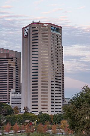
- AEP Ohio
- L Brands
- Anomatic
- Denison University
Fun Places to Visit
Licking County has many interesting places to explore:
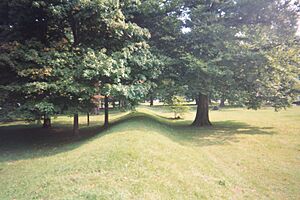
- Newark Earthworks: Ancient mounds built by Native Americans.
- Blackhand Gorge State Nature Preserve: A beautiful natural area with trails.
- Flint Ridge State Memorial: A place where ancient people mined flint.
- Dawes Arboretum: A large garden and nature preserve.
- Ye Olde Mill in Utica: Where delicious Velvet ice cream is made.
- Heisey Glass Museum: Learn about the history of glass making.
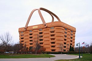
- Longaberger former basket facility: Once a famous building shaped like a giant basket.
- National Trail Raceway: A place for drag racing.
- Denison University: A well-known college.
- Home Building Association Bank: An important local bank.
Sports in Licking County
High schools in Licking County have strong sports programs. Some of these schools include Granville High School, Heath High School, and Newark High School.
Licking County high school baseball teams have been very successful. Since 2002, a team from Licking County has won a state title every year. For example, Newark Catholic High School and Heath High School together won nine state titles in just six years!
Local schools have also won state titles in other sports. Heath won in baseball and boys' track and field in 2007. Newark Catholic won in football in 2007. Newark won in boys' basketball in 2008, and Lakewood won in softball in 2008.
Towns and Communities
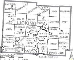
Licking County is made up of several cities, villages, and townships.
Cities
- Heath
- Johnstown
- New Albany
- Newark (the county seat)
- Pataskala
- Reynoldsburg
Villages
- Alexandria
- Buckeye Lake
- Granville
- Gratiot
- Hanover
- Hartford
- Hebron
- Kirkersville
- St. Louisville
- Utica
Townships
- Bennington
- Bowling Green
- Burlington
- Eden
- Etna
- Fallsbury
- Franklin
- Granville
- Hanover
- Harrison
- Hartford
- Hopewell
- Jersey
- Liberty
- Licking
- Madison
- Mary Ann
- McKean
- Monroe
- Newark
- Newton
- Perry
- St. Albans
- Union
- Washington
Census-designated places
These are areas that are not officially cities or villages but are recognized for census purposes:
Unincorporated communities
These are smaller communities that are not part of any city or village:
See also
 In Spanish: Condado de Licking para niños
 | Roy Wilkins |
 | John Lewis |
 | Linda Carol Brown |


