
Delaware County, Ohio facts for kids
Quick facts for kids
Delaware County
|
||
|---|---|---|

|
||
|
||

Location within the U.S. state of Ohio
|
||
 Ohio's location within the U.S. |
||
| Country | ||
| State | ||
| Founded | February 10, 1808 | |
| Named for | the Delaware Indians | |
| Seat | Delaware | |
| Largest city | Delaware* | |
| Area | ||
| • Total | 457 sq mi (1,180 km2) | |
| • Land | 443 sq mi (1,150 km2) | |
| • Water | 14 sq mi (40 km2) 3.1%% | |
| Population
(2020)
|
||
| • Total | 214,124 | |
| • Estimate
(2022)
|
226,296 |
|
| • Density | 468.5/sq mi (180.91/km2) | |
| Time zone | UTC−5 (Eastern) | |
| • Summer (DST) | UTC−4 (EDT) | |
| Congressional districts | 4th, 12th | |
| *Based on population just within the county. | ||

Delaware County is a special area called a county in the middle of Ohio, a state in the United States. In 2020, about 214,124 people lived here. The main city and county seat is Delaware.
The county was created in 1808. Both the county and its main city are named after the Delaware Native American tribe. Delaware County is known for being one of the wealthiest counties in the U.S. It is also part of the larger Columbus, Ohio, metropolitan area. A U.S. President, Rutherford B. Hayes, was born and grew up here. You can also find the famous Columbus Zoo and Aquarium in Delaware County!
Contents
History of Delaware County
The land that is now Delaware County was once home to many Native American tribes. In 1804, some people from Massachusetts, like Colonel Moses Byxbe, moved to central Ohio. They built a town on the Olentangy River.
On February 10, 1808, the state of Ohio officially created Delaware County. After the War of 1812, more settlers came to the area. They made their homes in the town of Delaware. This town became officially recognized as a city in 1816. Other towns like Powell (first called Middlebury) and Sunbury were also founded. Ohio Wesleyan University, a college, started here in 1842.
During the American Civil War, Delaware County supported the Northern states. People who wanted to end slavery, called abolitionists, used the Underground Railroad through this area. A local road, Africa Road, got its name from this time. Camp Delaware was a Civil War camp where African American soldiers trained.
The Civil War helped Delaware County grow. It brought new railroad businesses and technology. By 1900, Delaware had its first electric streetcar. An electric train line also connected Marion and Columbus through the county. The famous Little Brown Jug horse race began in 1946. It is a big part of the Triple Crown of Harness Racing for Pacers.
In recent years, Delaware County has been recognized as a great place to live. In 2008, Forbes magazine said it was one of the best places to raise a family in the U.S. In 2020, it was ranked as the best county to live in Ohio by Niche.
Geography of Delaware County
Delaware County covers about 457 square miles. Most of this area is land, with about 14 square miles of water. The land here is mostly flat and has very good soil for farming.
Neighboring Counties
Delaware County shares its borders with these other counties:
- Morrow County (north)
- Knox County (northeast)
- Licking County (east)
- Franklin County (south)
- Union County (west)
- Marion County (northwest)
Lakes and Rivers
Several important rivers flow through Delaware County from north to south. These include the Scioto River, Olentangy River, Alum Creek, and Big Walnut Creek. There are also two large lakes, Alum Creek Lake and Delaware Lake. These lakes are actually reservoirs, which are man-made lakes that store water.
Population in Delaware County
| Historical population | |||
|---|---|---|---|
| Census | Pop. | %± | |
| 1810 | 2,000 | — | |
| 1820 | 7,639 | 282.0% | |
| 1830 | 11,504 | 50.6% | |
| 1840 | 22,060 | 91.8% | |
| 1850 | 21,817 | −1.1% | |
| 1860 | 23,902 | 9.6% | |
| 1870 | 25,175 | 5.3% | |
| 1880 | 27,381 | 8.8% | |
| 1890 | 27,189 | −0.7% | |
| 1900 | 26,401 | −2.9% | |
| 1910 | 27,182 | 3.0% | |
| 1920 | 26,013 | −4.3% | |
| 1930 | 26,016 | 0.0% | |
| 1940 | 26,780 | 2.9% | |
| 1950 | 30,278 | 13.1% | |
| 1960 | 36,107 | 19.3% | |
| 1970 | 42,908 | 18.8% | |
| 1980 | 53,840 | 25.5% | |
| 1990 | 66,929 | 24.3% | |
| 2000 | 109,989 | 64.3% | |
| 2010 | 174,214 | 58.4% | |
| 2020 | 214,124 | 22.9% | |
| 2022 (est.) | 226,296 | 29.9% | |
| U.S. Decennial Census 1790-1960 1900-1990 1990-2000 2010-2020 |
|||
The population of Delaware County has grown a lot over the years. In 2010, there were about 174,214 people living here. By 2020, the population had grown to 214,124 people. Most people in the county are white, but there are also many Asian, Black, and other racial groups. About 2.1% of the population in 2010 was of Hispanic or Latino origin.
Schools in Delaware County
Delaware County has many school districts. These districts help educate students from kindergarten all the way through high school.
- Big Walnut Local SD
- Buckeye Valley Local SD
- Delaware City SD
- Dublin City SD²
- Elgin Local SD³
- Johnstown-Monroe Local SD5
- Northridge Local SD5
- North Union Local SD6
- Olentangy Local SD
- Westerville City SD7
- ² This district is mostly in Franklin County, but parts are in Delaware County and Union County.
- ³ This district is mostly in Marion County, but parts are in Delaware County.
- 5 This district is mostly in Licking County, but parts are in Delaware County.
- 6 This district is mostly in Union County, but parts are in Delaware County.
- 7 This district is mostly in Franklin County, but parts are in Delaware County.
Ohio Wesleyan University is a well-known college located in Delaware. It is considered one of the top liberal arts colleges in the United States.
Getting Around Delaware County
Main Roads
Many important highways run through Delaware County, making it easy to travel.
 I-71
I-71 US 23
US 23 US 36
US 36 US 42
US 42 SR 3
SR 3 SR 4
SR 4 SR 37
SR 37 SR 61
SR 61 SR 229
 SR 257
 SR 315
 SR 521
 SR 605
 SR 750
Airports
The Delaware Municipal Airport serves the area. It has a long runway and helps connect Delaware County to other places. About 80 aircraft are based there, and it sees around 40,000 flights each year. There are also a few smaller airports in the county.
Local News in Delaware County
The main local newspaper in Delaware County is Delaware Gazette. It has been published since 1885. The Sunbury News is another weekly newspaper that covers the eastern part of the county. There are also weekly papers like ThisWeek Delaware News and ThisWeek Olentangy Valley News. Students at Ohio Wesleyan University have their own newspaper called the Transcript.
Fun Places to Visit
Delaware County has many interesting places to visit and things to do!
- The Little Brown Jug: This is a very famous horse race that happens every year in Delaware. It's part of a big competition for harness racing horses.
- Columbus Zoo and Aquarium: A very popular zoo with many animals and exhibits.
- Zoombezi Bay Waterpark: A fun waterpark next to the zoo, perfect for hot days.
- Safari Golf Club: A place to play golf.
- Alum Creek State Park and Delaware State Park: These parks offer outdoor activities like hiking, boating, and camping. Millions of people visit them every year.
- The Strand Theater: A historic movie theater.
- Polaris Centers of Commerce: A large area with many businesses and shops, including the Polaris Fashion Place mall.
- Perkins Observatory: A place where you can look at stars and learn about space.
- The Ross Art Museum: An art museum with interesting collections.
Communities in Delaware County

Delaware County is made up of several different types of communities:
Cities
- Columbus (the state capital, mostly in Franklin County)
- Delaware (the main city and county seat)
- Dublin (partly in Franklin County and Union County)
- Powell
- Sunbury
- Westerville (mostly in Franklin County)
Villages
Census-Designated Places
These are areas that are like villages but are not officially incorporated.
Townships
Townships are smaller local government areas, often covering rural parts of the county.
- Berkshire
- Berlin
- Brown
- Concord
- Delaware
- Genoa
- Harlem
- Kingston
- Liberty
- Marlboro
- Orange
- Oxford
- Porter
- Radnor
- Scioto
- Thompson
- Trenton
- Troy
Unincorporated Communities
These are small communities that are not part of any city or village government.
Famous People from Delaware County
Many interesting people have lived in or are connected to Delaware County:
- Horace Newton Allen, a diplomat who worked with other countries.
- Ben Curtis, a professional golfer.
- Amos Dolbear, a scientist and inventor.
- Lou Ferrigno, an actor and bodybuilder, known for playing the Hulk.
- Arthur Sherwood Flemming, a statesman who worked in government.
- Jack Hanna, a famous zookeeper and TV personality from the Columbus Zoo and Aquarium.
- Lucy Webb Hayes, the 19th First Lady of the United States.
- Rutherford B. Hayes, the 19th President of the United States.
- Reuben James, a hero from the U.S. Navy.
- Clare Kramer, an actress.
- Vincente Minnelli, an Academy Award-winning film director.
- Norman Vincent Peale, a well-known author.
- John Purdue, who helped start Purdue University.
- Branch Rickey, an important person in MLB history.
- Buck Rodgers, a professional baseball player.
- William Rosecrans, a Major General in the U.S. Army.
- Frank Sherwood Rowland, a Nobel Prize winner for science.
- Ezra Vogel, a respected professor from Harvard University.
Images for kids
-
Seal of Delaware County, Ohio
-
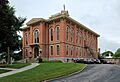
Delaware County Courthouse
See also
 In Spanish: Condado de Delaware (Ohio) para niños
