Stoney Down facts for kids
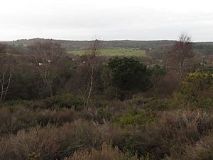
Stoney Down, also known as Stony Down, is a beautiful hill and a forested area in Dorset, England. The forest here is called the Stoney Down Plantation. It's a really big area, covering about 51 hectares (that's like 126 football fields!). This special place is popular with people who enjoy walking and horse riding. It's even been officially named an "Area of Great Landscape Value" because of its natural beauty.
Exploring Stoney Down
Where is Stoney Down?
Stoney Down is part of a larger special area near the village of Corfe Mullen. It's located about 2 kilometers (1.2 miles) west of Corfe Mullen's center. You can also find it about 2.5 kilometers (1.5 miles) east-northeast of Lytchett Matravers.
To the north of Stoney Down, across a valley, is another forest called Henbury Plantation. This area has sand and gravel pits and a high point called Notting Hill. To the northeast, you'll find the grounds of Castle Court School. East of Stoney Down is Corfe Mullen, and to the southeast are Poor Common and Beacon Hill. If you look far to the south and southwest, you can see the Purbeck Hills across Elder Moor.
What Does Stoney Down Look Like?
The highest point of Stoney Down hill is 83 meters (272 feet) tall. The main high points along the Stoney Down ridge include Barrow Hill (75 meters), Forest Hill (82 meters), Stoney Down itself (83 meters), and Allen Hill (80 meters). The Stoney Down Plantation forest covers most of this area, stretching from Rushall Lane to Brickyard Lane.
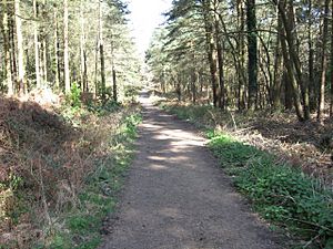
The forest is a mix of different types of trees. You'll find lots of pine, Douglas fir, and larch trees. There are also some very old, huge oak trees scattered around. You might also see groups of sweet chestnut trees. Two power lines cut through the forest, creating open, sandy paths. These paths also act as important firebreaks, helping to stop fires from spreading.


