Strattanville, Pennsylvania facts for kids
Quick facts for kids
Strattanville, Pennsylvania
|
|
|---|---|
|
Borough
|
|

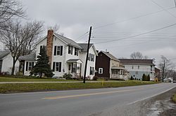
Houses on U.S. Route 322|Main Street
|
|

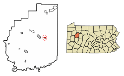
Location of Strattanville in Clarion County, Pennsylvania.
|
|

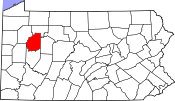
Map showing Clarion County in Pennsylvania
|
|
| Country | United States |
| State | Pennsylvania |
| County | Clarion |
| Settled | 1828 |
| Incorporated | 1850 |
| Government | |
| • Type | Borough Council |
| Area | |
| • Total | 0.50 sq mi (1.30 km2) |
| • Land | 0.50 sq mi (1.30 km2) |
| • Water | 0.00 sq mi (0.00 km2) |
| Elevation | 1,531 ft (467 m) |
| Population
(2020)
|
|
| • Total | 537 |
| • Estimate
(2021)
|
538 |
| • Density | 996.00/sq mi (384.34/km2) |
| Time zone | UTC-5 (Eastern (EST)) |
| • Summer (DST) | UTC-4 (EDT) |
| ZIP code |
16258
|
| FIPS code | 42-74728 |
Strattanville is a small town, also called a borough, located in Clarion County, Pennsylvania, United States. In 2020, about 537 people lived there.
History of Strattanville
Strattanville was first planned out in 1828 by John Strattan Sr. It is known as the oldest town in Clarion County. The first people settled here 11 years before Clarion County even existed!
In 1850, the village officially became a borough. Strattanville was one of the first three towns in Clarion County. It was even considered to be the main town, or "county seat," where the county offices would be.
However, because of political disagreements at the time, a new town was created just three miles away in Clarion, Pennsylvania, to be the county seat instead.
Strattanville still has many signs of its old history. For example, the old school house is now home to the local American Legion. The very first store owned by Mr. Strattan is still standing today. It is on the corner of Market Street and Main Street.
In the past, Strattanville had many different shops. These included four dry goods and grocery stores, a post office, a drug store, a hardware store, and more. Today, only the drug store and furniture store are still easily recognized from that time.
Geography and Location
Strattanville is in the eastern part of Clarion County. You can find it at these coordinates: 41°12′9″N 79°19′44″W / 41.20250°N 79.32889°W.
U.S. Route 322 goes right through the borough. If you go west on this road for about 3 miles (5 km), you will reach Clarion, which is the county seat. If you go east for about 4.5 miles (7.2 km), you will get to Interstate 80. Exit 64 on I-80 is about 3 miles (5 km) southwest of Strattanville if you take smaller roads.
The United States Census Bureau says that Strattanville covers a total area of about 0.50 square miles (1.31 km2). All of this area is land.
Population and People
| Historical population | |||
|---|---|---|---|
| Census | Pop. | %± | |
| 1860 | 323 | — | |
| 1870 | 356 | 10.2% | |
| 1880 | 317 | −11.0% | |
| 1890 | 331 | 4.4% | |
| 1900 | 262 | −20.8% | |
| 1910 | 376 | 43.5% | |
| 1920 | 461 | 22.6% | |
| 1930 | 487 | 5.6% | |
| 1940 | 604 | 24.0% | |
| 1950 | 562 | −7.0% | |
| 1960 | 547 | −2.7% | |
| 1970 | 559 | 2.2% | |
| 1980 | 555 | −0.7% | |
| 1990 | 490 | −11.7% | |
| 2000 | 542 | 10.6% | |
| 2010 | 550 | 1.5% | |
| 2020 | 537 | −2.4% | |
| 2021 (est.) | 538 | −2.2% | |
| Sources: | |||
Based on the census from 2000, there were 542 people living in Strattanville. These people lived in 243 households, and 150 of these were families. The population density was about 1,013.6 people per square mile (391.4/km2). There were 254 houses or apartments, with an average of 475.0 per square mile (183.4/km2).
About 29.6% of the households had children under 18 years old living with them. About 43.2% were married couples living together. Around 12.8% had a female head of the house without a husband present. About 37.9% were not families.
The average household had 2.22 people, and the average family had 2.73 people.
The age breakdown of the population showed that 23.2% were under 18 years old. About 9.6% were between 18 and 24 years old. The largest group, 33.0%, was between 25 and 44 years old. About 19.4% were between 45 and 64 years old, and 14.8% were 65 years or older. The average age in the borough was 36 years.
For every 100 females, there were about 88.2 males. For every 100 females aged 18 and over, there were about 81.7 males.
See also
 In Spanish: Strattanville para niños
 | Mary Eliza Mahoney |
 | Susie King Taylor |
 | Ida Gray |
 | Eliza Ann Grier |


