
Strawn, Texas facts for kids
Quick facts for kids
Strawn, Texas
|
|
|---|---|
.jpg)
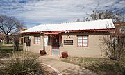
City Hall
|
|

Location of Strawn, Texas
|
|
 |
|
| Country | United States |
| State | Texas |
| County | Palo Pinto |
| Area | |
| • Total | 0.79 sq mi (2.03 km2) |
| • Land | 0.78 sq mi (2.02 km2) |
| • Water | 0.01 sq mi (0.02 km2) |
| Elevation | 1,004 ft (306 m) |
| Population
(2020)
|
|
| • Total | 540 |
| • Density | 684/sq mi (266.0/km2) |
| Time zone | UTC-6 (Central (CST)) |
| • Summer (DST) | UTC-5 (CDT) |
| ZIP code |
76475
|
| Area code(s) | 254 |
| FIPS code | 48-70580 |
| GNIS feature ID | 2411989 |
Strawn is a small city in Palo Pinto County, Texas, United States. In 2020, about 540 people lived there. Strawn is located in the southwestern part of Palo Pinto County. It sits along Highway 16 and Highway 108.
The city started around 1880 when the Texas and Pacific Railway began its service. Before that, the area was called North Fork. This name came from its location on Palo Pinto Creek. The city was planned on land owned by two early ranchers, Stephen Bethel Strawn and James N. Stuart. James N. Stuart built the very first house in the area in 1875. Two smaller communities nearby, Russell's Pocket and Davidsonville, joined together to form Strawn.
Contents
About Strawn's Location
Strawn is a small city, covering about 0.8 square miles (2.03 square kilometers). All of this area is land.
Strawn's Weather
The weather in Strawn is usually warm. Summers are hot and humid, meaning they feel sticky and wet. Winters are generally mild, not too cold. This type of weather is called a humid subtropical climate.
People of Strawn
The number of people living in Strawn has changed over the years. Here's a look at how the population has grown and shrunk:
| Historical population | |||
|---|---|---|---|
| Census | Pop. | %± | |
| 1890 | 514 | — | |
| 1920 | 2,457 | — | |
| 1930 | 1,429 | −41.8% | |
| 1940 | 1,107 | −22.5% | |
| 1950 | 922 | −16.7% | |
| 1960 | 817 | −11.4% | |
| 1970 | 786 | −3.8% | |
| 1980 | 694 | −11.7% | |
| 1990 | 709 | 2.2% | |
| 2000 | 739 | 4.2% | |
| 2010 | 653 | −11.6% | |
| 2020 | 540 | −17.3% | |
| U.S. Decennial Census | |||
In 2020, there were 540 people living in Strawn. There were 282 households, which are groups of people living together. Out of these, 185 were families.
Learning in Strawn
The Strawn Independent School District serves the city of Strawn. This school district is responsible for the education of children and teens in the area.
Photo Gallery
-
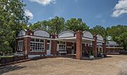
Zim's Cafe
-
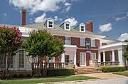
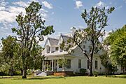
The Watson House
-
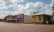
Downtown Strawn
-
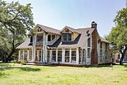
James Nesbit Stuart House
-
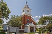
St. John's Catholic Church
-
R.C. Hinkson House
-
Strawn Civic Center
-
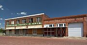
Bankhead Hotel
-
Strawn Historical Museum Association
.jpg)
.jpg)
.jpg)
.jpg)
.jpg)
.jpg)
.jpg)

.jpg)
See also
 In Spanish: Strawn (Texas) para niños
