Stuart Island (Washington) facts for kids

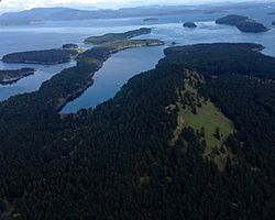
South-facing aerial view of Reid Harbor on Stuart Island
|
|

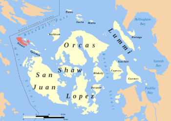
Location of Stuart Island within the San Juan Islands
|
|
| Geography | |
|---|---|
| Coordinates | 48°40′25″N 123°12′18″W / 48.6736°N 123.2051°W |
| Archipelago | San Juan Islands |
| Area | 7.462 km2 (2.881 sq mi) |
| Administration | |
|
United States
|
|
| County | San Juan |
| State | Washington |
Stuart Island is one of the beautiful San Juan Islands. It is located north of San Juan Island and west of Waldron Island in the state of Washington, United States. This island is about 7.462 km2 (3 sq mi) in size.
Stuart Island is home to people who live there all year or part-time. It also has a state park, a special one-room schoolhouse, and two places where small planes can land.
Contents
History of Stuart Island
Stuart Island got its name from Charles Wilkes. He was a leader of the United States Exploring Expedition, a big trip that happened between 1838 and 1842. Wilkes named the island to honor Frederick D. Stuart, who was a clerk on his ship during the expedition.
Another important place on the island is Prevost Harbor. It was named after James Charles Prevost. He was the captain of a ship called HMS Satellite. You can also find Prevost Island in British Columbia, Canada, which is named after him. Satellite Island is named after his ship.
Fun Things to Do on Stuart Island
Parks and Outdoor Activities
Stuart Island has two main areas that are part of Stuart Island State Park. These areas are open to the public. One part of the park is near the middle of the island. The other part is on the western coast.
This western part is where you can find the Turn Point Light Station. This is a lighthouse that helps guide ships safely through the busy waters of Boundary Pass, which is north of the island. The land around the lighthouse is managed by the Bureau of Land Management.
Boaters can find safe places to drop anchor in Reid Harbor and Prevost Harbor. Both of these harbors have public facilities that are part of the state park.
Satellite Island is a small island located in Prevost Harbor. It is used by YMCA Camp Orkila. This camp uses Satellite Island for exciting trips for teenagers and for field trips for younger campers.
Getting Around Stuart Island
There are two small airstrips on Stuart Island. These are like small airports for private planes.
- The Stuart Island Airstrip (called 7WA5) has a grass runway that is about 2,000 ft (610 m) long.
- The Stuart Island West airstrip (called 2WA3) has a dirt runway that is about 1,560 ft (475 m) long.
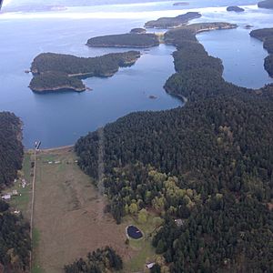
Images for kids
See also
 In Spanish: Isla Stuart (Washington) para niños
 | Charles R. Drew |
 | Benjamin Banneker |
 | Jane C. Wright |
 | Roger Arliner Young |


