Stuart Range, South Australia facts for kids
Quick facts for kids Stuart Range |
|
|---|---|
| Highest point | |
| Geography | |
| Location | Coober Pedy |
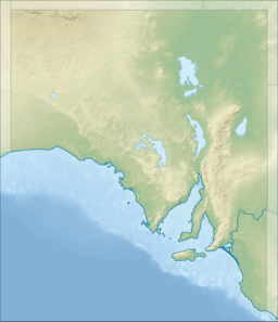
The Stuart Range is a group of low hills in central South Australia. It stretches for about 170 kilometres (110 mi) (105 miles). The range runs from the north-west to the south-east. It passes about 10 kilometres (6.2 mi) (6 miles) south-east of the town of Coober Pedy.
Contents
What's in a Name?
This range is named after a famous explorer, John McDouall Stuart. He was the first European explorer to travel through this area. He explored the region in the year 1858.
How the Stuart Range Formed
The Stuart Range was created by powerful forces deep within the Earth. Long, long ago, during the Cretaceous and Tertiary periods, the Earth's crust in central Australia was squeezed. This squeezing caused the land to gently fold and push upwards. This is how the Stuart Range began to form.
Rocks and Colors of the Range
Underneath the Stuart Range are layers of old rock. One important layer is called the Bulldog Shale. This rock formed a very long time ago, during the Early Cretaceous period. It is made of grey mudstones that were once at the bottom of the sea.
When the Bulldog Shale is exposed to the air and rain for a long time, it changes. Water and chemicals in the soil cause it to break down. This process is called chemical weathering. It makes the rock lighter in color and creates the "multi-hued, picturesque colouration" you can see today. This means the landscape has many beautiful colors.
How Silcrete Rock is Made
The long process of chemical weathering also dissolved a material called silica. Silica is found in many rocks. This dissolved silica then moved through the soil and rock layers with groundwater. When the conditions changed, the silica hardened again. It formed a very tough rock called silcrete.
Silcrete is a type of duricrust, which is a hard crust on the Earth's surface. The silica acts like a glue, binding tiny rock grains together. This creates hard sheets of rock, often parallel to the ground.
Types of Silcrete Formation
Silcrete can form in different ways:
- Groundwater silcrete forms deeper underground. It happens where the groundwater table is, usually in lower areas like valleys.
- Pedogenic silcrete forms closer to the surface. It develops within the soil itself. This type often creates large, wide sheets of hard rock.
Over millions of years, as the land slowly wore away, the silcrete became exposed. It formed a protective layer of hard rocks called gibbers. These gibbers are also known as a desert pavement. They act like armor, protecting the softer soil and rock underneath from erosion. This is why the landscapes in this area are often flat or gently rolling plains.
Water Flow and Landforms
For a very long time, the Stuart Range has been an important natural boundary for water. It separates two large drainage areas: the Eucla Basin and the Lake Eyre basin. This means that rain falling on one side of the range flows towards the Eucla Basin, while rain on the other side flows towards the Lake Eyre basin.
In some places, rivers and streams have cut deep into the land. This has created gullies and shaped the landscape. It forms a special type of landform called a tableland. Here, the land looks like a flat table with steep sides. Over time, the edges of these tablelands slowly wear away. This leaves behind isolated hills called mesas and buttes. These hills keep their shape because they have a hard cap of silcrete on top. Eventually, even this hard cap wears away.
 | Isaac Myers |
 | D. Hamilton Jackson |
 | A. Philip Randolph |


