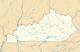
Stuffley Knob (Johnson County, Kentucky) facts for kids
Quick facts for kids Stuffley Knob |
|
|---|---|
| Highest point | |
| Elevation | 1,496 ft (456 m) |
| Geography | |
| Location | Johnson County, Kentucky, U.S. |
| Topo map | USGS Oil Springs |
| Climbing | |
| First ascent | unknown |
| Easiest route | Hike |
Stuffley Knob is the tallest mountain in Johnson County, Kentucky. It stands high above the land, reaching almost 1,500 feet into the sky. This mountain is an important landmark in its area.
Contents
All About Stuffley Knob
Stuffley Knob is a well-known natural feature in eastern Kentucky. It is a part of the beautiful Appalachian region. The mountain's name, "Knob," often refers to a rounded hill or mountain.
Where is Stuffley Knob Located?
Stuffley Knob is found in Johnson County, Kentucky, in the United States. It is about eight miles west of a town called Paintsville. You can find it close to U.S. Route 460.
To find its exact spot on a map, people use special numbers called coordinates. Stuffley Knob is located at 37°46′59″N 82°55′13″W / 37.78306°N 82.92028°W. Think of these numbers like a special address for a place on Earth.
How Tall is Stuffley Knob?
Stuffley Knob reaches an elevation of 1,496 feet (which is about 456 meters). This height is measured from sea level. Sea level is the average height of the ocean's surface. It is used as a starting point to measure how high or low places are on land.
Because of its height, Stuffley Knob is the highest point in all of Johnson County. It offers great views of the surrounding area.
What Can You Do at Stuffley Knob?
The easiest way to explore Stuffley Knob is by hiking. Hiking means walking long distances, often on trails in nature. While the first person to climb Stuffley Knob is unknown, many people enjoy exploring its slopes today. It's a great place for outdoor adventures.
 | Laphonza Butler |
 | Daisy Bates |
 | Elizabeth Piper Ensley |


