Johnson County, Kentucky facts for kids
Quick facts for kids
Johnson County
|
|
|---|---|
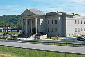
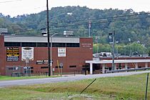
Johnson County Judicial Center in Paintsville
|
|
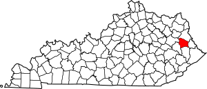
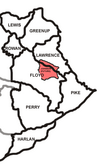
Location within the U.S. state of Kentucky
|
|
 Kentucky's location within the U.S. |
|
| Country | |
| State | |
| Founded | February 24, 1843 |
| Named for | Richard Mentor Johnson |
| Seat | Paintsville |
| Largest city | Paintsville |
| Area | |
| • Total | 264 sq mi (680 km2) |
| • Land | 262 sq mi (680 km2) |
| • Water | 2.2 sq mi (6 km2) 0.8%% |
| Population
(2020)
|
|
| • Total | 22,680 |
| • Estimate
(2023)
|
22,116 |
| • Density | 85.91/sq mi (33.17/km2) |
| Time zone | UTC−5 (Eastern) |
| • Summer (DST) | UTC−4 (EDT) |
| Congressional district | 5th |
Johnson County is a place in Kentucky, a state in the USA. In 2020, about 22,680 people lived there. Its main town is Paintsville. The county was created in 1843 and named after Richard Mentor Johnson. He was a brave colonel in the War of 1812 and later became a Vice President of the United States.
Johnson County is known as a "moist county." This means that most of the county does not allow alcohol sales. However, its main town, Paintsville, does allow alcohol sales.
Contents
History of Johnson County
How Johnson County Was Formed
Johnson County was officially created on February 24, 1843. It was made from parts of Floyd, Lawrence, and Morgan counties. At that time, Paintsville was already an established town for nine years. People had started building homes in Paintsville as early as the 1810s.
Many of the first families in Johnson County came from Scotland, Ireland, England, or Germany. Some also came from France, but they were often thought to be English because they traveled through England to get to the United States. Many of these early settlers moved from North Carolina, Pennsylvania, and Virginia. They came after fighting in the American Revolutionary War.
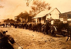
For about 25 years, Johnson County and Paintsville grew slowly. There were almost no good roads. Mail and supplies arrived by horseback and steamboat from the Bluegrass region. Later, stagecoaches helped connect eastern Kentucky and Johnson County to other areas.
The Civil War Years
As Johnson County and Paintsville began to grow, the American Civil War started in 1860. This war caused many problems. Like other border areas, families were torn apart as brothers fought on different sides. Johnson County was not only in a border state during the Civil War, but it was also a border county itself.
At one point, the county tried to ban both the Union and Confederate flags. But this rule was quickly removed. This happened after Colonel James Garfield's Union soldiers marched through Paintsville. They raised the United States Flag over the town courthouse. They were on their way to fight the Confederate army at the Battle of Middle Creek in Floyd County.
John C. C. Mayo's Influence
After the Civil War, a talented teacher named Thomas Jefferson Mayo moved to Paintsville. His son, John C. C. Mayo, became a very important person in eastern Kentucky's growth. People in the county have different ideas about him. Some say he was a good person who helped Paintsville and Johnson County develop. They believe he helped create banks, churches, streets, public services, and railroads.
Others say he was responsible for how much power coal companies gained over the county's coal. They believe this is why the area has faced economic challenges.
Coal was important for Johnson County even before the Civil War. But its development stopped when the war began. It was hard to get money for the coal industry in eastern Kentucky after the war. This slowed down growth in Johnson County. People were wary of outsiders. But Mayo was a teacher and someone they knew, so he was trusted. He helped the coal industry get started in eastern Kentucky. He also helped connect the area to the industrial North, which led to railroads being built.
During this time, many people in Johnson County were given wrong information. They sold the rights to the minerals on their land for very little money. Sometimes, they traded their mineral rights for something as simple as a new shotgun. Also, many people lost their land because of fires in several county towns. These fires destroyed important papers like deeds. This made it easier for others to take land that owners did not want to give up.
The Chesapeake and Ohio Railway opened its Paintsville station on September 1, 1904. This happened after 25 years of work to connect it to Lawrence County. Local citizens helped pay for the rails through donations, stocks, and bonds. After the railroad was built, thousands of tons of coal were shipped out of eastern Kentucky by 1910.
Mayo also became a political helper. He was the only person from eastern Kentucky on the Democratic National Committee. He helped elect Kentucky's governors, members of Congress, and even Woodrow Wilson as President.
He passed away on May 11, 1914, after getting sick during a trip to Europe. During his life, he built a famous house in Paintsville. It is now known as Mayo Mansion.
Geography of Johnson County
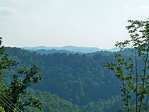
Johnson County covers about 264 square miles. Most of this (262 square miles) is land, and a small part (2.2 square miles) is water.
The highest point in the county is Stuffley Knob. It is about 1,496 feet high. The lowest point is the Levisa Fork river on the border with Lawrence County. It is about 550 feet high.
Neighboring Counties
- Lawrence County (north)
- Martin County (east)
- Floyd County (south)
- Magoffin County (southwest)
- Morgan County (northwest)
Transportation
Main Roads
 U.S. Route 23
 U.S. Route 460
 Kentucky Route 40
 Kentucky Route 321
 Kentucky Route 3
Airports
The closest airport is Big Sandy Regional Airport. It is in Martin County, right next to Johnson County. This airport is used for private planes.
For flights with passengers, the nearest airport is Tri-State Airport. It is about 55 miles northeast in Ceredo, West Virginia.
Population Information
| Historical population | |||
|---|---|---|---|
| Census | Pop. | %± | |
| 1850 | 3,873 | — | |
| 1860 | 5,306 | 37.0% | |
| 1870 | 7,494 | 41.2% | |
| 1880 | 9,155 | 22.2% | |
| 1890 | 11,027 | 20.4% | |
| 1900 | 13,730 | 24.5% | |
| 1910 | 17,482 | 27.3% | |
| 1920 | 19,622 | 12.2% | |
| 1930 | 22,968 | 17.1% | |
| 1940 | 25,771 | 12.2% | |
| 1950 | 23,846 | −7.5% | |
| 1960 | 19,748 | −17.2% | |
| 1970 | 17,539 | −11.2% | |
| 1980 | 24,432 | 39.3% | |
| 1990 | 23,248 | −4.8% | |
| 2000 | 23,445 | 0.8% | |
| 2010 | 23,356 | −0.4% | |
| 2020 | 22,680 | −2.9% | |
| 2023 (est.) | 22,116 | −5.3% | |
| U.S. Decennial Census 1790–1960 1900–1990 1990–2000 2010–2020 |
|||
In 2000, there were 23,445 people living in Johnson County. Most people (98.64%) were White. About 24% of the population was under 18 years old. The average age was 37 years.
The median income for a family in the county was about $29,142 per year. About 26.6% of the people lived below the poverty line. This included 35.5% of those under 18.
Education in Johnson County
Public Schools
Johnson County has two public school districts.
Johnson County Schools
The Johnson County School District runs schools throughout the county, including Paintsville. These schools include:
- Porter Elementary
- W.R. Castle Elementary
- Highland Elementary
- Flat Gap Elementary
- Central Elementary
- Johnson County Middle School
- Johnson Central High School
Central Elementary was once ranked as a top elementary school in Kentucky for testing. It was also a top-performing elementary school in the Southeastern U.S.
Johnson County Middle School's academic team has won the most State Governor's Cups. They won in 1999, 2000, 2004, 2006, 2007, 2008, 2009, 2010, 2012, 2013, and 2014. Their Future Problem Solving team has also won state and international awards.
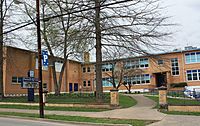
Johnson Central High School is known for its academic, football, and basketball teams. It was recently named a U.S. News & World Report Top American High School. The high school offers many clubs like STLP, FBLA, DECA, Beta, FFA, HOSA, SkillsUSA, and FCCLA. Johnson Central also has a new Career Technology Center.
Paintsville Independent Schools
The Paintsville Independent School District also runs two schools:
- Paintsville Elementary School (for grades K-6)
- Paintsville High School (for grades 7-12)
Paintsville High has won many sports titles. Their boys' teams have won state championships in football, basketball, baseball, and golf.
Both the Johnson County and Paintsville Independent districts met all the "No Child Left Behind" standards.
Private Schools
Two private schools are in the county:
- Our Lady of the Mountain School (grades K-8)
- The Piarist School (a college prep school for grades 6-12)
Colleges
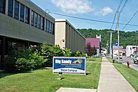
Big Sandy Community and Technical College has two campuses in Johnson County: Mayo and Hager Hill.
Fun Places to Visit
Kentucky Apple Festival
In 1914, the first county fair was held in Paintsville. This was also when the first Apple King was crowned.
Since 1962, Johnson County has hosted the annual Kentucky Apple Festival in Paintsville. The streets of downtown Paintsville are closed for the festival. There is live music, entertainment, and various competitions.
Parks and Recreation
- Paintsville Lake State Park
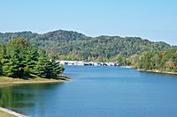
This beautiful state park has a 1,140-acre lake. It also has a 12,404-acre wildlife management area. You can find a marina, boat docks, a restaurant, and a convenience store. You can rent boats, have picnics, and use playgrounds. There are also places to camp. It is located on Route 2275 at Staffordsville, near Paintsville.
- Paintsville Recreation Center
The Paintsville Recreation Center has a basketball court, a playground, and a volleyball court. It is on Preston Street in Paintsville.
- Paintsville Country Club & Golf Course
This 18-hole golf course opened on September 27, 1929. It is one of the oldest golf courses in Eastern Kentucky. The country club building was built in 1930 and is on the National Register of Historic Places. It is located on Kentucky Route 1107 in Paintsville.
Museums
- U.S. 23 Country Music Highway Museum
This museum shares the stories of country music stars who grew up near U.S. Route 23 in Eastern Kentucky. It is located at 120 Staves Branch in Paintsville.
- The Coal Miners' Museum
This museum tells the history of coal mining in the local area. It is on Millers Creek Road in Van Lear.
Historical Sites
- Mayo Mansion
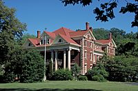
This large 43-room house was built by John C. C. Mayo between 1905 and 1912. Today, it is home to Our Lady of the Mountains School. It is on Third Street in Paintsville.
- Mayo Memorial United Methodist Church
John C. C. Mayo also had this church built. He hired 100 builders from Italy to construct it. The church has an organ given by Andrew Carnegie and beautiful stained glass windows. It opened in the fall of 1909. It is on Third Street in Paintsville, next to Mayo Mansion.
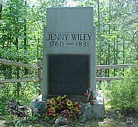
- Jenny Wiley Gravesite
Jenny Wiley was a real person who was captured by Native Americans in Virginia. She escaped and later lived in Johnson County until she passed away in 1831. Her grave is just off Highway 581 at River.
Other Interesting Places
- Loretta Lynn Homeplace
This is the childhood home of the famous country music singer, Loretta Lynn. It is located at Butcher Hollow in Van Lear.
- Forrest and Maxie Preston Memorial Bridge
This 420-foot long swinging bridge is the world's longest plastic bridge. The bridge deck is made of a strong, special plastic material. It crosses the Levisa Fork of the Big Sandy River. It connects the communities of River and Offutt. It is on Kentucky Route 581 at River.
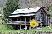
- Mountain Homeplace
The Mountain Homeplace shows what a farming community in Eastern Kentucky looked like in the mid-1800s. It has a one-room schoolhouse, a church, a blacksmith shop, a cabin, a barn, and farm areas. You can also see demonstrations of old-time skills and crafts. It is located near the dam at Paintsville Lake State Park.
Communities
City
Other Communities
- Asa
- Boonscamp
- Chandlerville
- Collista
- Denver
- Dobson
- East Point
- Elna
- Flat Gap
- Fuget
- Hager Hill
- Hargis
- Keaton
- Kerz
- Leander
- Low Gap
- Manila
- Meally
- Nero
- Nippa
- Odds
- Offutt
- Oil Springs
- Redbush
- River
- Riceville
- Sip
- Sitka
- Staffordsville
- Stambaugh
- Swamp Branch
- Thealka
- Thelma
- Tutor Key
- Van Lear
- Volga
- West Van Lear
- Whitehouse
- Williamsport
- Winifred
- Wittensville
Famous People From Johnson County
- Loretta Lynn: A legendary country singer. Her 2004 album, Van Lear Rose, talks about growing up in Van Lear, Johnson County.
- Tyler Childers: A singer-songwriter who went to Paintsville High School.
- Crystal Gayle: A country singer and Loretta Lynn's younger sister.
- Chris Stapleton: A Grammy award-winning country musician.
- Jenny Wiley: A historical figure who lived in Johnson County after escaping captivity.
- John C. C. Mayo: An important businessman who helped bring railroad service to eastern Kentucky.
- Jim Ford: A singer-songwriter.
- Hylo Brown: A bluegrass and country music singer.
- Johnnie LeMaster: A former major league baseball player, mostly with the San Francisco Giants.
- John Pelphrey: A basketball star for the University of Kentucky and a former head basketball coach for the University of Arkansas.
- Willie Blair: A former Major League Baseball player.
See also
 In Spanish: Condado de Johnson (Kentucky) para niños
 | Selma Burke |
 | Pauline Powell Burns |
 | Frederick J. Brown |
 | Robert Blackburn |


