Sula Sgeir Lighthouse
Comhairle Nan Eilean Siar
 |
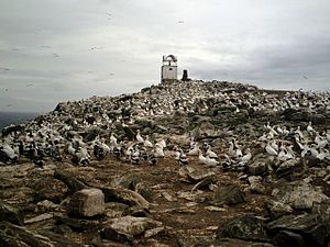
| Lighthouse and Cairn on Sulasgeir |

Sula Sgeir Lighthouse
Comhairle Nan Eilean Siar
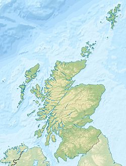
Location in Scotland
|
| Location |
Sula Sgeir |
| Coordinates |
59°5′37.47″N 6°9′31.97″W / 59.0937417°N 6.1588806°W / 59.0937417; -6.1588806 |
| Foundation |
concrete base |
| Construction |
metal tower |
| Tower shape |
square parallelepiped with lantern |
| Markings / pattern |
white tower |
| Height |
5 metres (16 ft) |
| Focal height |
74 metres (243 ft) |
| Range |
11 nautical miles (20 km; 13 mi) |
| Characteristic |
Fl W 15s. |
| Admiralty number |
A3870 |
| NGA number |
3572 |
| ARLHS number |
SCO-230 |

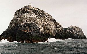
Sula Sgeir from the South West.
Sula Sgeir is a small, empty Scottish island in the North Atlantic Ocean. It is one of the most faraway islands in the British Isles. This island is a tough place for people to live because of its rocky land. There's even a ruined stone house called Taigh Beannaichte, which means "Blessed House." Even though it's small, Sula Sgeir is super important for birds. It has been a special protected area called a National Nature Reserve since 1956.
Exploring Sula Sgeir's Caves
One of the most interesting parts of Sula Sgeir are its caves. These natural tunnels in the rock can be explored, offering a unique adventure for visitors.
Amazing Birdlife: Sula Sgeir's Feathered Friends
Sula Sgeir is a very important home for many different kinds of birds. It's especially famous for its large number of gannets. About 5,000 pairs of gannets come here to breed and raise their young.
These gannets share the island with other cool bird species. You can also find Black-legged Kittiwakes, guillemots, puffins, and fulmars living on Sula Sgeir. It's like a busy bird city!
Images for kids
-
Aerial view of Sula Sgeir
-


