Sullivan's Gulch, Portland, Oregon facts for kids
Quick facts for kids
Sullivan's Gulch
|
|
|---|---|
|
Neighborhood
|
|
|
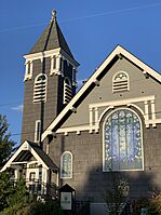
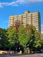
Clockwise from top left: Lloyd Center MAX station, Holladay Park, the Fontaine condominium tower, neighborhood sign topper, historic houses in the snow, Steeplejack Brewing Company
|
|
| Country | United States |
| State | Oregon |
| City | Portland |
| Area | |
| • Total | 0.32 sq mi (0.83 km2) |
| Population
(2000)
|
|
| • Total | 3,043 |
| • Density | 9,500/sq mi (3,666/km2) |
| Housing | |
| • No. of households | 1804 |
| • Occupancy rate | 95% occupied |
| • Owner-occupied | 475 households (26%) |
| • Renting | 1329 households (74%) |
| • Avg. household size | 1.69 persons |
Sullivan's Gulch is a neighborhood in Portland, Oregon. It is located in the northeast part of the city. The neighborhood is named after Timothy Sullivan. He was an early farmer who settled in the area.
Timothy Sullivan was born in Ireland in 1805. He moved to the United States and became a citizen in 1855. He claimed land here on January 27, 1851. This was part of a special program called a "donation land claim." It helped people get land in the Oregon Territory.
The Sullivan's Gulch neighborhood is a busy place. It is next to the Lloyd District. It also borders Irvington, Grant Park, and Kerns.
The actual "gulch" is a long, narrow valley. It stretches east from the Willamette River. Long ago, it was a beautiful area with forests and waterfalls. During the Great Depression, some people who had lost their homes lived there. They built small shelters in what was called a "Hooverville."
Today, the gulch is a major route for transportation. It has tracks for the MAX Light Rail system. There are also Union Pacific train tracks. Interstate 84, also known as the Banfield Freeway, runs through it. A walking and biking trail, the Sullivan's Gulch Trail, is being planned. The first train tracks were laid in 1882.
How Sullivan's Gulch Was Formed
The gulch itself was created by giant floods. These floods happened about 13,000 to 15,000 years ago. This was at the end of the last ice age. A huge ice dam held back Glacial Lake Missoula. This dam broke about 40 times. Each time, it caused massive floods.
These floodwaters rushed across Idaho and eastern Washington. They surged down the Columbia River and through the Gorge. The floods then filled the Willamette Valley. They reached as far south as Eugene.
During these floods, Portland was covered by about 400 feet (120 meters) of water. The floods left behind a lot of silt and gravel. This helped create the Alameda Ridge. It also carved out the valley we now call Sullivan's Gulch.
 | Laphonza Butler |
 | Daisy Bates |
 | Elizabeth Piper Ensley |


