
Glacial Lake Missoula facts for kids
Quick facts for kids Lake Missoula |
|
|---|---|

Lake Missoula
Location in Montana
|
|
| Location | Western Montana |
| Area | 7,770 km2 (3,000 sq mi) |
| Designated: | 1966 |
| Lake Missoula | |
|---|---|

Wave-cut strandlines cut into the slope at left in photo. These cuts record former high-water lines, or shorelines. Gullies above the highway are the result of modern-day erosion. (NPS Photo)
|
|

Lake Missoula
Location in Montana
|
|
| Location | North America |
| Coordinates | 46°56′20″N 114°08′37″W / 46.93889°N 114.14361°W |
| Lake type | former lake |
| Primary inflows | Channeled Scablands |
| Primary outflows | Wallula Gap of the Columbia River |
| Basin countries | United States |
| Max. length | 200 mi (320 km) |
| Max. width | 57 mi (92 km) |
| Surface area | 7,700 km2 (2,973 sq mi) |
| Max. depth | 2,000 ft (610 m) |
| Water volume | 2,100 km3 (500 cu mi) |
| Residence time | N/A due to multiple historic fill / drain events |
| Surface elevation | 4,206 ft (1,282 m) |

Imagine a giant lake, half the size of Lake Michigan, that appeared and disappeared many times! That's exactly what Lake Missoula was. It was a huge prehistoric lake in western Montana. This lake existed at the end of the last ice age, about 15,000 to 13,000 years ago.
The area where Lake Missoula once stood is now a National Natural Landmark. It's known for its amazing "great ripples." These ripples are like huge waves made of land, some as tall as a two-story building! They helped scientists understand how massive floods shaped the landscape.
Contents
How Lake Missoula Formed
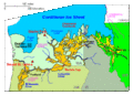
Lake Missoula formed because of a giant ice dam. A large sheet of ice, called the Cordilleran ice sheet, pushed south from British Columbia. A part of this ice sheet blocked the Clark Fork River in Idaho Panhandle. This ice dam was incredibly tall, sometimes reaching over 610 metres (2,000 ft) high. It held back a huge amount of water, flooding the valleys of western Montana for about 320 kilometres (200 mi) eastward. Lake Missoula was the largest lake ever known to be held back by an ice dam.
The Missoula Floods
The ice dam that created Lake Missoula didn't last forever. It broke open many times, leading to massive, sudden floods known as the Missoula Floods. These floods swept across eastern Washington and down the Columbia River Gorge. This happened about 40 times over a period of 2,000 years!
These floods were incredibly powerful. They carved out huge canyons and other landforms in eastern Washington, creating what we now call the Channeled Scablands. The floods moved a massive amount of dirt, sand, and rocks. They are famous because they show how big changes to the Earth can happen very quickly, not just slowly over millions of years.
Scientists believe that some of the oldest Missoula floods happened even earlier, over 1.5 million years ago. Evidence for these older floods is harder to find because later floods washed away much of the proof.
Evidence of the Ancient Lake
Ice Dam on the Clark Fork River
The Cordilleran ice sheet was a huge glacier. A part of it, called the Purcell Lobe, moved south into the Idaho Panhandle. It blocked the Clark Fork River, which was the main river system in western Montana. This ice dam was about 610 metres (2,000 ft) deep and stretched for at least 16 kilometres (9.9 mi). It reached as far east as Cabinet, Montana, and south to Bayview, Idaho.
Lake Levels and Size
Lake Missoula filled many valleys in western Montana. It's named after the city of Missoula. If you visit the mountains around Missoula, you can still see "strandlines." These are like ancient bathtubs rings, showing where the lake's shoreline used to be nearly 20,000 years ago.
At its biggest, Lake Missoula was over 610 metres (2,000 ft) deep. It held as much water as Lake Erie and Lake Ontario combined! The lake covered an area of about 7,770 square kilometres (3,000 sq mi). Its shoreline was at an elevation of about 1,280 metres (4,200 ft).
The lake spread far and wide:
- East of Missoula, it reached 417 kilometres (259 mi) to Gold Creek.
- Northeast up the Blackfoot River, it went 435 kilometres (270 mi) to Lake Alva.
- To the south, the Bitterroot Valley filled up to Sula, Montana, 460 kilometres (290 mi).
- To the north, the Flathead River basin became a huge body of water. It even made Red Sleep Mountain an island!
The water in Lake Missoula was deep, dark, and cloudy with sediment. Scientists think the sediment, called rock flour, made it hard for fish to live there. There's no evidence that large animals like mammoths or bison, or even humans, lived in the immediate area of the lake.
Features Left by the Lake
The powerful forces of Lake Missoula and the floods left behind many interesting geological features.
Clark Fork Canyon Features
The Clark Fork River canyon shows signs of the ancient lake.
- Nine Mile Rhythmites: Near Ninemile, you can see layers of light pink sand and silt. These layers were deposited at the bottom of the lake when the water was still. Each pair of layers (darker and lighter) represents a period when the lake filled up and then drained. The darker layers are fine particles from winter, and the lighter layers are coarser particles from summer. These layers show that the lake filled and drained many times over about 1,000 years.
Flathead Basin Features
The Flathead basin was right next to the ice sheet.
- Camas Prairie Mega Ripples: In the Camas Prairie, you can see huge ripples made of sediment. These ridges are about 7.6 metres (25 ft) high and 30 metres (98 ft) apart. They formed when the lake drained quickly, creating powerful currents that shaped the land.
- Markle Pass Kolks: In Markle Pass, you can find "kolks." These are holes carved into the bedrock by strong underwater whirlpools. When Lake Missoula drained, these tornado-like currents spun so fast they pulled rocks out of the ground!
Missoula Basin Features
The area around Missoula also has clear signs of the lake.
- Glacial Erratic: On the grounds of the University of Montana, there's a large rock called a glacial erratic. This rock was carried by the glacier and dropped far from where it originally came from.
- Strandlines: You can clearly see the ancient strandlines on the slopes of Mount Jumbo and Mount Sentinel near Missoula. These lines show the different levels of the lake as the ice dam broke and reformed.
Images for kids
-
Cordilleran Ice Sheet

See also
 In Spanish: Lago Missoula para niños
- Missoula floods
- Glacial lake outburst flood
- Giant current ripples
- Ice Age Floods National Geologic Trail
- List of prehistoric lakes
