Sun Run (Ararat River tributary) facts for kids
Quick facts for kids Sun Run |
|
|---|---|
|
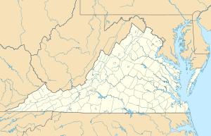
Location of Sun Run mouth
|
|
| Other name(s) | Tributary to Ararat River |
| Country | United States |
| State | Virginia |
| County | Patrick |
| Physical characteristics | |
| Main source | Big Laurel Creek divide about 0.25 miles east of Groundhog Mountain 2,730 ft (830 m) 36°38′42″N 080°31′19″W / 36.64500°N 80.52194°W |
| River mouth | Ararat River about 2 miles northwest of Carters Mill, Virginia 1,365 ft (416 m) 36°36′50″N 080°30′13″W / 36.61389°N 80.50361°W |
| Length | 2.85 mi (4.59 km) |
| Basin features | |
| Progression | east then south |
| River system | Yadkin River |
| Basin size | 1.80 square miles (4.7 km2) |
| Tributaries |
|
| Bridges | Goosecreek Lane (x2), Raven Rock Road |
Sun Run is a small stream, about 2.85 mi (4.59 km) long, located in Patrick County, Virginia. It's a "first-order tributary," which means it's one of the smallest streams that flows into a larger river. Sun Run joins the Ararat River. What makes Sun Run special is that it's the only stream with this name in the entire United States!
Sun Run's Journey
Sun Run begins its journey in Patrick County, Virginia. It starts near a place called Groundhog Mountain, on a high area that separates different water flows, known as the Big Laurel Creek divide.
From its starting point, Sun Run first flows towards the east. Then, it makes a turn and heads south. Its journey ends when it flows into the Ararat River. This meeting point is about 2 miles northwest of a small town called Carters Mill, Virginia.
The Land Around Sun Run
The area that Sun Run drains, called its watershed, covers about 1.80 square miles (4.7 km2). This means all the rain that falls in this area will eventually flow into Sun Run.
The region around Sun Run gets a good amount of rain, about 54.3 inches each year. A large part of this area, about 80%, is covered by forests. This helps keep the water clean and provides homes for many plants and animals.
 | John T. Biggers |
 | Thomas Blackshear |
 | Mark Bradford |
 | Beverly Buchanan |


