Söderhamn Municipality facts for kids
Quick facts for kids
Söderhamn Municipality
Söderhamns kommun
|
||
|---|---|---|

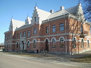
Railway station in Söderhamn
|
||
|
||
 |
||
| Country | Sweden | |
| County | Gävleborg County | |
| Seat | Söderhamn | |
| Area | ||
| • Total | 2,294.93 km2 (886.08 sq mi) | |
| • Land | 1,064.92 km2 (411.17 sq mi) | |
| • Water | 1,230.01 km2 (474.91 sq mi) | |
| Area as of January 1, 2010. | ||
| Population
(June 30, 2012)
|
||
| • Total | 25,742 | |
| • Density | 11.21690/km2 (29.0516/sq mi) | |
| Time zone | UTC+1 (CET) | |
| • Summer (DST) | UTC+2 (CEST) | |
| ISO 3166 code | SE | |
| Province | Hälsingland | |
| Municipal code | 2182 | |
| Website | www.soderhamn.se | |
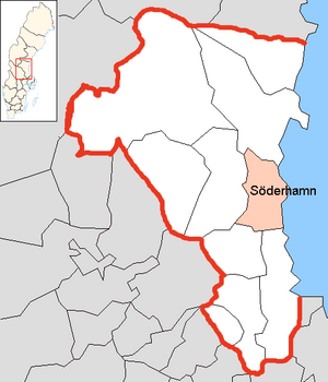
Söderhamn Municipality (which is Söderhamns kommun in Swedish) is a special area in Gävleborg County, located in east-central Sweden. Think of a municipality like a local government area, similar to a county or district in other countries. It helps manage local services and rules.
The main town and administrative center of this municipality is Söderhamn. The municipality as we know it today was created in 1971. This happened when the old City of Söderhamn joined together with a few smaller rural areas nearby.
Towns and Villages
Söderhamn Municipality is made up of several smaller towns and villages. Each of these places adds to the unique character of the area.
- Bergvik
- Ljusne
- Marmaskogen
- Marmaverken
- Mohed
- Sandarne
- Skog
- Söderala
- Söderhamn (This is the main town!)
- Vallvik
- Vannsätter
International Connections
Söderhamn Municipality has special friendships with towns in other countries. These are called "twin towns" or "sister cities." They often share ideas and cultures.
 Kunda, Estonia
 Jakobstad, Finland
 Os, Hordaland, Norway
 Szczecinek, Poland
See also
 In Spanish: Municipio de Söderhamn para niños
 | Misty Copeland |
 | Raven Wilkinson |
 | Debra Austin |
 | Aesha Ash |


