Tūtaekurī River facts for kids
Quick facts for kids Tūtaekurī River |
|
|---|---|
 |
|
| Country | New Zealand |
| Physical characteristics | |
| Main source | Kaweka Ranges 759 m (2,490 ft) |
| River mouth | Heretaunga Plains Sea Level |
| Length | 99.9 km (62.1 mi) |
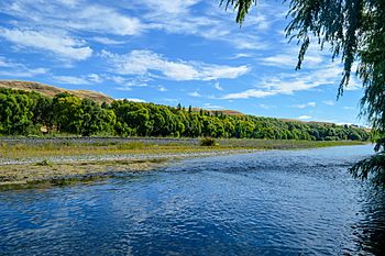
The Tūtaekurī River is an important river that flows through the Hawke's Bay area on the eastern side of New Zealand's North Island. It begins high up in the Kaweka Range and flows towards the east. The river reaches the Pacific Ocean just south of the cities of Napier and Taradale. Here, other rivers like the Ngaruroro and Clive River join it.
The Tūtaekurī River starts about 50 kilometers northeast of Taihape. It travels a long distance, flowing for nearly 100 kilometers (99.9 kilometers) before reaching the sea.
Contents
River's History and Name
The Tūtaekurī River has been important to local Māori people for a very long time.
Māori Connections to the River
The local Māori sub-tribe, called hapū in Māori, is Ngāti Paarau. They used this river for many purposes. Other tribes, like Ngāti Pahauwera, also traveled to this river. They would meet here to share food and trade goods with each other.
Meaning of the River's Name
The name Tūtaekurī comes from the Māori language. It can be broken down into two parts:
- tūtae – which means waste or droppings
- kurī – which means dog
So, the name relates to "dog waste" or "dog droppings."
How the River Changed Course
The Tūtaekurī River did not always flow in the same path it does today. A major event in 1931 changed its route.
The 1931 Hawke's Bay Earthquake
Before 1931, the lowest part of the Tūtaekurī River flowed north. It followed its original channel, which is where the town of Taradale is located today. This old path led into Ahuriri Harbour.
However, a powerful event called the 1931 Hawke's Bay earthquake changed everything. During this earthquake, the land under Ahuriri Harbour was lifted up a lot. This made it impossible for the river to flow into the harbor anymore.
Creating a New Path
Because its old path was blocked, the Tūtaekurī River started to back up. To prevent flooding and help the river flow, the people living in Hawke's Bay dug a new path for the river. This new path connected the Tūtaekurī River to the Ngaruroro River. The Tūtaekurī River still flows into the Ngaruroro River today, following this new route created after the earthquake.
 | Isaac Myers |
 | D. Hamilton Jackson |
 | A. Philip Randolph |

