Ngaruroro River facts for kids
Quick facts for kids Ngaruroro River |
|
|---|---|

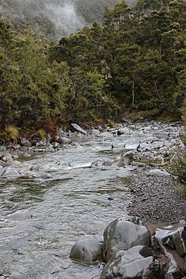
Ngaruroro River in the Kaweka Range
|
|

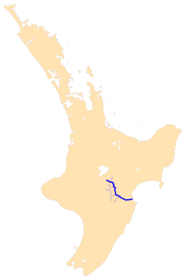
Ngaruroro river system
|
|
| Native name | Ngaruroro |
| Counrty | New Zealand |
| Region | Hawkes Bay |
| Physical characteristics | |
| Main source | Kaimanawa Range |
| River mouth | Hawke Bay Sea level 39°34′S 176°56′E / 39.567°S 176.933°E |
| Length | 164 kilometres (102 mi) |
The Ngaruroro River is a long river in the eastern part of the North Island of New Zealand. It flows for about 164 kilometres (102 miles). The river starts in the Kaweka Range, Kaimanawa Range, and Ruahine Range mountains. It flows southeast and then east. Finally, it empties into Hawke Bay. This is near the town of Clive, between the cities of Napier and Hastings.
Contents
River's Journey and Features
The Ngaruroro River is mostly a single, narrow stream for its first 45 kilometres. It flows through a deep, rocky gorge made of greywacke rock. After this, near a place called Whanawhana, the river becomes wider. It then splits into many smaller channels that weave together. This is called a braided channel. The Maraekakaho River also joins the Ngaruroro here.
Where Rivers Meet the Sea
The Ngaruroro River shares its mouth with a few other rivers. These include the Tutaekuri River, the Clive River, and Muddy Creek. When all these rivers meet, they form an area called the Waitangi Estuary. An estuary is where a river meets the sea, and fresh water mixes with salt water.
How the River Shaped the Land
The Ngaruroro is one of several rivers that helped create the Heretaunga Plains. These plains are flat areas of land near the coast of Hawke Bay. They were formed over a very long time by the rivers. The rivers carried alluvial material, like sand, silt, and clay, and deposited it. This made the land very fertile.
Changes in the River's Path
The Ngaruroro River has not always flowed in the same path. It used to flow along what is now the Clive River. But in 1867, there was a very big flood. This flood changed the river's course to mostly where it flows today. Later, in 1969, the last 4 kilometres (2.5 miles) of the river were moved. This was done to help stop floods from happening. The Karamu and Clive rivers still exist, but they now drain smaller areas of land.
Land Around the River
The land around the Ngaruroro River is used for different things. About 40% of the land is used for pasture, which means it's used for animals to graze. The other 55% is covered in native forest.
Fun Activities on the River
The upper part of the Ngaruroro River flows through the Kaweka Forest Park. This area is popular for many outdoor activities. People enjoy trout fishing here, especially for rainbow trout. It's also a great place for rafting, tramping (which is like hiking), and hunting for deer.
The River and Groundwater
The Ngaruroro River is very important for the water underground. It helps to refill the Heretaunga groundwater aquifer. An aquifer is like a huge underground sponge that holds fresh water. The river adds about 4 cubic metres of water per second to this aquifer. This underground water then feeds several streams in the area, like Raupare and Irongate. It also provides water for the many fruit orchards on the Heretaunga Plains. Eventually, this underground water flows out into the sea through springs about 20 kilometres (12 miles) off the coast.
What's in a Name?
The exact meaning of the name "Ngaruroro" is not fully known.
 | Tommie Smith |
 | Simone Manuel |
 | Shani Davis |
 | Simone Biles |
 | Alice Coachman |

