Tanamá, Arecibo, Puerto Rico facts for kids
Quick facts for kids
Tanamá
|
|
|---|---|
|
Barrio
|
|

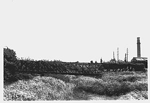
Cambalache Bridge in Tanamá and Cambalache (c. 1993)
|
|

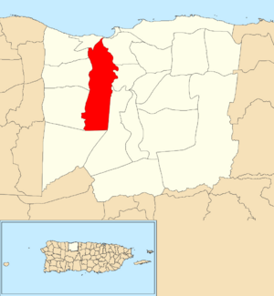
Location of Tanamá within the municipality of Arecibo shown in red
|
|
| Commonwealth | |
| Municipality | |
| Area | |
| • Total | 8.29 sq mi (21.5 km2) |
| • Land | 8.17 sq mi (21.2 km2) |
| • Water | 0.12 sq mi (0.3 km2) |
| Elevation | 43 ft (13 m) |
| Population
(2010)
|
|
| • Total | 3,190 |
| • Density | 390.5/sq mi (150.8/km2) |
| Source: 2010 Census | |
| Time zone | UTC−4 (AST) |
Tanamá is a special area, like a neighborhood, located in the town of Arecibo, Puerto Rico. In 2010, about 3,190 people lived there.
A Look at Tanamá's Past
Tanamá has an interesting history, especially how it became part of the United States. After the Spanish–American War, Spain gave Puerto Rico to the United States. This happened because of a peace agreement called the Treaty of Paris of 1898.
After this, Puerto Rico became an unincorporated territory of the United States. This means it's a place that belongs to the U.S. but isn't a state. In 1899, the United States government counted everyone living in Puerto Rico. This count is called a census. The census found that 1,023 people lived in Tanamá barrio at that time.
| Historical population | |||
|---|---|---|---|
| Census | Pop. | %± | |
| 1900 | 1,023 | — | |
| 1950 | 3,776 | — | |
| 1980 | 3,716 | — | |
| 1990 | 3,797 | 2.2% | |
| 2000 | 3,413 | −10.1% | |
| 2010 | 3,190 | −6.5% | |
| U.S. Decennial Census 1899 (shown as 1900) 1910-1930 1930-1950 1980-2000 2010 |
|||
Exploring Tanamá's Neighborhoods (Sectors)
Barrios like Tanamá are often divided into even smaller local areas. These smaller areas are called sectores (which means sectors in English). Think of them as smaller neighborhoods within a larger one.
The names of these sectores can be different. Some are simply called sector, while others might be named urbanización, reparto, barriada, or residencial. Each name describes a different type of community or housing area.
Here are some of the sectors you can find in Tanamá barrio:
Comunidad Abra San Francisco, Condominios Villa Campestre, Sector Charco Hondo, Sector Colloral, Sector Curva de Bravo, Sector El Dique, Sector Higuillales, Sector Juan Saúl, Sector La Guinea, Sector La Planta, Sector Los Caños, Sector Los Chinos, Sector Marcos Soto, Sector Ojo del Agua, Sector Oriente, Urbanización Camino del Valle, Urbanización Estancias de la Riviera, Urbanización Valle Verde, and Urbanización Villa Ángela.
More to Explore
 In Spanish: Tanamá (Arecibo) para niños
- List of communities in Puerto Rico
- List of barrios and sectors of Arecibo, Puerto Rico
 | John T. Biggers |
 | Thomas Blackshear |
 | Mark Bradford |
 | Beverly Buchanan |


