Tanyard Branch (Marshyhope Creek tributary) facts for kids
Quick facts for kids Tanyard Branch |
|
|---|---|

Tanyard Branch in Delaware
|
|
|
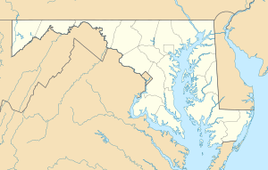
Location of Tanyard Branch mouth
|
|
| Other name(s) | Tributary to Marshyhope Creek |
| Country | United States |
| State | Maryland Delaware |
| Counties | Caroline Sussex |
| Physical characteristics | |
| Main source | divide between Tanyard Branch and Bucks Branch of Clear Brook Creek about 2 miles southwest of Atlanta, Delaware 50 ft (15 m) 38°41′42″N 075°41′26″W / 38.69500°N 75.69056°W |
| River mouth | Marshyhope Creek Federalsburg, Maryland 5 ft (1.5 m) 38°41′11″N 075°46′21″W / 38.68639°N 75.77250°W |
| Length | 4.96 mi (7.98 km) |
| Basin features | |
| Progression | west |
| River system | Nanticoke River |
| Basin size | 4.93 square miles (12.8 km2) |
| Tributaries |
|
| Waterbodies | Lake Chambers |
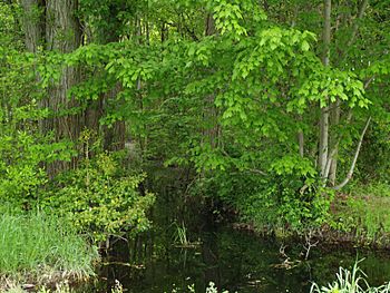
Tanyard Branch is a small stream, or "tributary," that flows into a larger body of water called Marshyhope Creek. It is about 4.96 miles (7.98 kilometers) long. This stream starts in western Sussex County, Delaware and travels west. It eventually crosses into Caroline County, Maryland before joining Marshyhope Creek.
Contents
What is Tanyard Branch?
Tanyard Branch is a natural waterway. It helps carry water from the land to bigger rivers and eventually to the ocean. Think of it like a small road that connects to a main highway. In this case, the main highway is Marshyhope Creek.
Where Does Tanyard Branch Start?
The journey of Tanyard Branch begins in Delaware. Its source is a natural high point, or "divide," in the land. This spot separates its waters from another stream called Bucks Branch of Clear Brook Creek. The starting point is about 2 miles (3.2 kilometers) southwest of a town called Atlanta, Delaware. The elevation at its source is about 50 feet (15 meters) above sea level.
Where Does Tanyard Branch End?
After flowing for nearly 5 miles, Tanyard Branch reaches its end. It flows into Marshyhope Creek near Federalsburg, Maryland. At this point, the elevation is much lower, only about 5 feet (1.5 meters) above sea level. This drop in elevation helps the water flow downhill.
How Long and Wide is Tanyard Branch?
Tanyard Branch is 4.96 miles (7.98 kilometers) long. This makes it a relatively short stream. While its exact width can change, it's generally a narrow waterway. The amount of water flowing through it, called "discharge," averages about 5.79 cubic feet per second (0.16 cubic meters per second) where it meets Marshyhope Creek.
What Area Does Tanyard Branch Flow Through?
Tanyard Branch flows through two different states in the United States. It starts in Delaware and then enters Maryland. Specifically, it crosses through Sussex County, Delaware and Caroline County, Maryland. The entire area that collects water for Tanyard Branch is called its "basin." This basin covers about 4.93 square miles (12.77 square kilometers).
Connections to Other Waterways
Tanyard Branch is part of a larger network of rivers. It flows into Marshyhope Creek, which then flows into the Nanticoke River. The Nanticoke River is a major river system in the region. Tanyard Branch also has smaller, unnamed streams that flow into it. These are called "tributaries." There is also a small lake called Lake Chambers within its basin.
 | Delilah Pierce |
 | Gordon Parks |
 | Augusta Savage |
 | Charles Ethan Porter |


