Tauere facts for kids

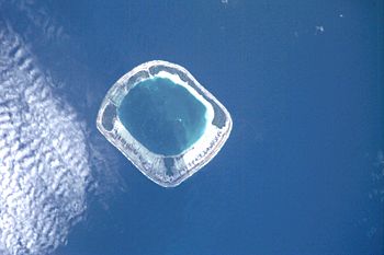
NASA picture of Tauere Atoll
|
|
| Geography | |
|---|---|
| Location | Pacific Ocean |
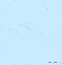
| Coordinates | 17°22′S 141°28′W / 17.367°S 141.467°W |
| Archipelago | Tuamotus |
| Area | 60 km2 (23 sq mi) (lagoon) 3.9 km2 (1.5 sq mi) (above water) |
| Length | 7.5 km (4.66 mi) |
| Administration | |
|
France
|
|
| Overseas collectivity | French Polynesia |
| Administrative subdivision | Tuamotus |
| Commune | Hao |
| Demographics | |
| Population | 3 (2012) |

Tauere Atoll, also known as Taouere or Te Putua, is a small group of islands in the central Tuamotu Archipelago. This island group is part of French Polynesia. It is located about 85 kilometers (53 miles) northwest of the western tip of Hao Atoll.
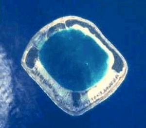
Tauere Atoll has a unique squarish shape. It measures about 7.5 kilometers (4.7 miles) across. The actual islands are found on its northern and eastern sides. The lagoon in the middle of the atoll is not connected to the open ocean. This makes Tauere Atoll quite hard to reach.
People Living on Tauere
Tauere Atoll is home to very few people. In 2012, only 3 people lived there. A few years earlier, in 2007, there were 7 inhabitants. This makes Tauere one of the least populated places in the world.
History of Tauere Atoll
The first Europeans to see Tauere Atoll were part of a Spanish trip led by Pedro Fernandez de Quirós. They spotted the atoll on February 12, 1606. They named it La Decena.
Later, another Spanish sailor named Domingo de Boenechea saw the atoll. This was on October 28, 1772. He was sailing on a ship called Aguila from Callao, Peru. His goal was to start a new settlement on Tahiti. Boenechea called this atoll San Simon y Judas. Because of this, you might see Tauere Atoll called St. Simon on some old maps.
How Tauere Is Governed
Tauere Atoll is part of a larger administrative area. It belongs to the commune of Amanu. A commune is like a local government area. The main village for this commune is Ikitake. The Amanu commune also includes another uninhabited atoll called Rekareka.
The Amanu commune is then connected to the Hao commune. This means that Hao helps manage the areas around it, including Tauere.
See also
 In Spanish: Tauere para niños
 | Frances Mary Albrier |
 | Whitney Young |
 | Muhammad Ali |


