Hao (French Polynesia) facts for kids
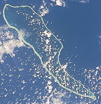
NASA picture of Hao Atoll
|
|
| Geography | |
|---|---|
| Location | Pacific Ocean |
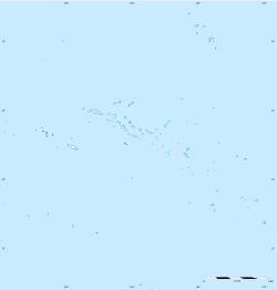
| Coordinates | 18°4′31″S 140°56′43″W / 18.07528°S 140.94528°W |
| Archipelago | Tuamotus |
| Area | 720 km2 (280 sq mi) (lagoon) 35 km2 (14 sq mi) (above water) |
| Length | 50 km (31 mi) |
| Width | 14 km (8.7 mi) |
| Highest elevation | 3 m (10 ft) |
| Administration | |
|
France
|
|
| Overseas collectivity | French Polynesia |
| Administrative subdivision | Îles Tuamotu-Gambier |
| Commune | Hao |
| Largest settlement | Otepa |
| Demographics | |
| Population | 1027 (2017) |
|
Hao
|
||
|---|---|---|
|
||
 |
||
| Country | France | |
| Overseas collectivity | French Polynesia | |
| Subdivision | Îles Tuamotu-Gambier | |
| Area
1
|
65.0 km2 (25.1 sq mi) | |
| Population
(2017)
|
1,258 | |
| • Density | 19.354/km2 (50.13/sq mi) | |
| Time zone | UTC−10:00 | |
| INSEE/Postal code |
98720 /98767
|
|
| Elevation | 0–3 m (0.0–9.8 ft) | |
| 1 French Land Register data, which excludes lakes, ponds, glaciers > 1 km2 (0.386 sq mi or 247 acres) and river estuaries. | ||
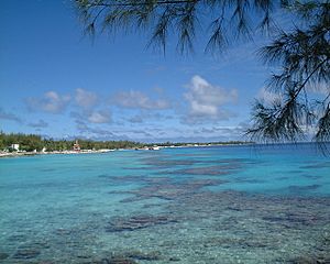
Hao, also known as Haorangi, is a large coral atoll in the central part of the Tuamotu Archipelago. An atoll is a ring-shaped island made of coral, surrounding a lagoon. About 1,000 people live on Hao, which has a land area of 35 km2 (14 sq mi).
Hao was once an important military support base. It helped with nuclear tests on the nearby island of Mururoa. Because of its unique shape, French explorer Louis Antoine de Bougainville called it "Île de la Harpe," which means "Harp Island."
Contents
Geography of Hao Atoll
Hao is located about 920 km (570 mi) east of Tahiti. The atoll is 50 km (31 mi) long and 14 km (8.7 mi) wide. Its large lagoon covers an area of 720 km2. This makes it the fourth largest lagoon in French Polynesia.
The lagoon has only one passage for ships. This passage is at Kaki, on the north side of the atoll. Strong currents can flow through this passage, reaching speeds of up to 20 knots.
The climate on Hao is maritime, meaning it's influenced by the ocean. Temperatures usually stay between 23 and 32 °C all year round. The main town on Hao is Otepa. Here, people mostly work in growing pearls.
Population and People of Hao
The main village on Hao is Otepa. In 2017, about 1,027 people lived there. The population grew a lot when the Pacific Experimentation Center (CEP) base was built for nuclear testing. However, the number of people has slightly decreased in recent years.
Religion on Hao
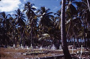
Most people on Hao follow Christianity. This is because of missionaries from both Catholic and Protestant groups. The Catholic Church started its work here in the 1800s. There is a church in Otepa called St. Peter's Church (Église de Saint-Pierre). It is part of the Roman Catholic Archdiocese of Papeete, which is based on the island of Tahiti.
History of Hao Atoll
The first European to arrive at Hao was Pedro Fernández de Quirós on February 10, 1606. He named the island Conversion de San Pablo. Later, José Andía y Varela visited in 1774.
As mentioned, French explorer Louis Antoine de Bougainville named it "Île de la Harpe" (Harp Island) because of its shape. On some old maps, it is also called Bow Island.
In 1820, Russian explorer Fabian Gottlieb von Bellingshausen visited Hao. It was the first atoll in the Tuamotus he explored with his ships Vostok and Mirni.
In the late 1980s, two French intelligence agents were briefly held on the military base here. This happened after a diplomatic issue between New Zealand and France.
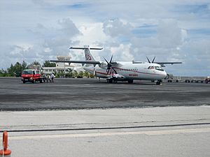
Hao's military airfield, now called Hao Airport, became a civilian airport in 2000. This airport is very important. It serves many smaller eastern Tuamotus islands. Their own landing strips are too short for larger planes that fly to Tahiti.
The future of Hao's economy is still being figured out. The military base closed permanently in 2002. This base was a major support center for nuclear testing on Mururoa. Many facilities, like electrical and desalinization plants and the hospital, also closed. This affected many people who worked for the military base.
Administration of Hao
Hao is part of a larger group of islands that form the commune of Hao. A commune is like a local government area. This commune is part of the administrative subdivision of Îles Tuamotu-Gambier. The main town for the commune is Otepa.
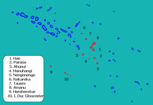
The commune of Hao includes three smaller areas:
- Hao itself, plus the uninhabited islands of Ahunui, Nengonengo, Manuhangi, and Paraoa.
- Amanu, which includes the uninhabited islands of Rekareka and Tauere.
- Hereheretue, which includes the uninhabited islands of Anuanuraro and Anuanurunga, and the inhabited island of Nukutepipi.
In 2017, the total population of the Hao commune was 1,258 people.
Transport on Hao
Hao Airport ((IATA: HOI, ICAO: NTTO)) is located in the northern part of the island. It is used by Air Tahiti, which is the main airline for domestic flights in French Polynesia.
Economy of Hao
During the 1960s, the Pacific Experimental Center base was the main source of jobs and money for Hao. Many buildings and services were built during this time. These included a large airfield with a 3,380 meter runway. NASA even listed this runway as an emergency landing strip for the space shuttle Columbia. There was also a cargo port, a 15 km road, water desalination units, electric generators, and a hospital.
Fishing, Pearl Farming, and Aquaculture
Since 2000, the main private businesses on Hao have been pearl farming and fishing. About ten tons of seafood are exported to Tahiti each year. People also harvest copra, which comes from coconuts.
In 2017, a Chinese businessman announced plans to build a large aquaculture farm on Hao. Aquaculture is like farming fish in water. This project aimed to produce a lot of lagoon fish for export. The government of French Polynesia supported this idea. It was hoped that the project would create many jobs for local people. This would help the economy of the atoll, especially since the French army left. Some early work was done, but the project has faced delays.
People have raised questions about how this project might affect the environment.
Public Services and Education
Hao airfield handles about 800 flights and 12,000 to 15,000 passengers each year. About 30% of these passengers are just passing through.
The island also has a secondary school for children from the southern Tuamotu and Gambier atolls. There is also a vocational training institute called CETAD. It teaches skills related to sea professions. Many teachers come from France for a few years to work here.
Hao got a modern desalination plant in 2005. This plant turns saltwater into fresh drinking water. Electricity is always available, supplied by generators. In 2006, streetlights powered by wind turbines and solar panels were installed. In 2018, a special submarine cable called Natitua connected Hao to Tahiti. This brought high-speed Internet to the island.
See also
 In Spanish: Hao (atolón) para niños
 | James Van Der Zee |
 | Alma Thomas |
 | Ellis Wilson |
 | Margaret Taylor-Burroughs |


