Gambier Islands facts for kids
|
Native name:
Îles Gambier
|
|
|---|---|
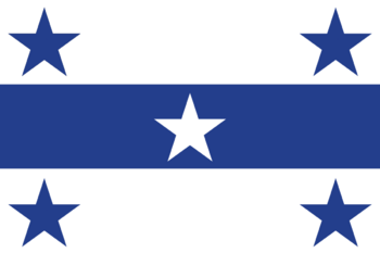
Flag of the Gambier Islands
|
|
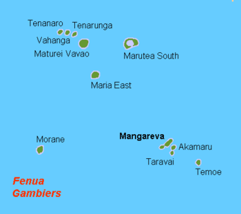
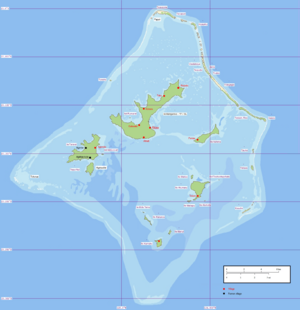
Map of the commune of Gambier, showing to the north-west the islands that are part of the commune but belong to the Tuamotu Archipelago, and to the south-east the Gambier Islands proper (Mangareva, Akamaru, Taravai, Temoe).
|
|
| Geography | |
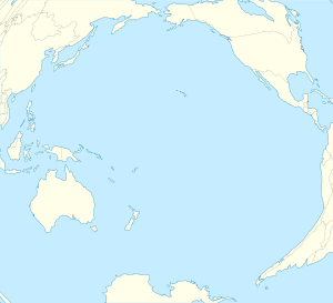
| Location | Pacific Ocean |
| Coordinates | 23°07′S 134°58′W / 23.117°S 134.967°W |
| Archipelago | Polynesia |
| Total islands | 14 |
| Major islands | Mangareva, Akamaru, Aukena, Taravai |
| Area | 27.8 km2 (10.7 sq mi) |
| Administration | |
| Collectivity | |
| Largest settlement | Rikitea |
| Demographics | |
| Population | 1,431 (Aug. 2017) |
| Pop. density | 51 /km2 (132 /sq mi) |
| Additional information | |
| Time zone |
|
The Gambier Islands (French: Îles Gambier or Archipel des Gambier) are a group of islands in French Polynesia. They are located at the very end of the Tuamotu island chain. These islands cover an area of about 27.8 square kilometers (10.7 square miles).
The Gambier Islands include the Mangareva Islands, which are high islands formed from an old volcano. They also have smaller islets on the surrounding coral reef. The uninhabited Temoe atoll is also part of the group. It lies about 45 km (28 mi) southeast of the Mangareva Islands.
People usually see the Gambier Islands as a separate group from the Tuamotu islands. This is because their culture and language (Mangarevan) are more like those of the Marquesas Islands. Also, the Tuamotus are mostly coral atolls, but the Mangareva Islands are volcanic. They have tall central islands.
The Gambier Islands are part of the commune of Gambier. This commune also includes some atolls in the Tuamotu Archipelago. The main office for the commune is on Mangareva. This is the biggest island in the Gambier Islands group.
In 2017, 1,431 people lived in the Gambier Islands. All of them lived on the Mangareva Islands.
Contents
Exploring the History of the Gambier Islands
Early History of the Islands
Experts believe that the first people to settle the Gambier Islands came from the Society Islands. This happened around 1000 A.D. There is proof that Polynesians settled on several islands. These include Mangareva, Taravai, Agakauitai, Akamaru, Aukena, and Kamaka.
The people lived in a strict tribal society. They often had wars between different groups. Sometimes, there was not enough food. Before Europeans arrived, there was a lot of unrest and civil war. This made it easier for King Pomaré II of Tahiti to take control in the early 1800s. The islands remained under Tahiti's influence for many years.
European Discoveries and Settlement
Europeans first found the Gambier Islands in 1797. This happened when James Wilson, captain of the ship Duff, arrived. He was on a mission for the London Missionary Society. Wilson named the islands after James Gambier. Gambier had helped pay for the trip.
In 1825, British explorer Frederick William Beechey visited the islands. He was on a long journey across the Pacific.
Missionaries Arrive in the Islands
In 1834, Catholic missionaries Honoré Laval and François Caret came to the islands. They wanted to start the first Catholic mission in Polynesia. At first, King Maputeoa, the last king of Mangareva, did not want them there. But after he got better from a serious illness, he became more open to their ideas. He was baptized in 1836.
With the king's help, the missionaries started many building projects. They taught the islanders to read and write. They also tried to protect them from European traders. Father Laval believed that "civilization leads to contentment."
The missionaries replaced old statues and temples with new stone buildings. They built over a hundred churches, chapels, and other structures. The cathedral of St. Michael in Mangareva was very large. It could hold more than 2,000 people.
Many workers were sent from Mangareva to Tahiti. They helped build the cathedral of Papeete in 1856. This led to fewer people on the smaller Gambier Islands. The population also went down because of new diseases. However, the missionaries also stopped tribal wars and other harmful practices.
The French governor of Tahiti did not get involved for many years. But when traders complained, he finally stepped in. Father Laval had to leave Mangareva in 1871. He passed away in 1880.
The Gambier Islands officially became part of France on February 21, 1881. This was approved by the President of France in 1882.
Effects of Nuclear Testing
The Gambier Islands were used as a base for French nuclear testing. These tests happened in Mururoa, about 400 kilometers away. During this time, the French military made a wider channel in the coral reefs. This allowed larger ships to pass. After this, more people reported getting sick from ciguatera, a type of food poisoning from fish.
Geography of the Gambier Islands
The Gambier Islands include the Mangareva Islands. These islands have a coral reef around them. This reef has only three openings to the open sea. The Temoe atoll is also part of the group. It is located 45 km (28 mi) southeast of the Mangareva Islands.
In the Mangareva Islands, Mangareva is the main island. Other important high islands are Akamaru, Angakauitai, Aukena, Kamaka, and Taravai. These islands are mostly of volcanic origin. Some other islands are coral islands.
The Mangareva Islands have a land area of 25.71 square kilometers. In 2017, 1,431 people lived there. The main town is Rikitea, on Mangareva. The highest point in the Gambiers is Mt. Duff. It rises to 441 meters (1,447 feet) on Mangareva's south coast.
The Gambier Islands include:
- Temoe atoll (2.1 km²; no one lives there): It has one main island and many small motus.
- Mangareva Islands (25.71 km²; 1,431 people in 2017):
- Islands in the central lagoon (only high islands have people living on them):
- To the north, the high island of Mangareva (13.93 km²; 1,384 people).
- To the northeast, the high island of Aukena (1.41 km²; 25 people).
- To the southeast, the high island of Akamaru (1.96 km²; 12 people).
- To the south, the high island of Kamaka (0.47 km²; 1 person).
- To the west, the high islands of Taravai (4.96 km²; 8 people) and Angakauitai (0.76 km²; 1 person).
- Low islands on the coral reef (no one lives on these):
- These include many small islets like Tenoko, Papuri, and Totegegie (where the airport is).
- Islands in the central lagoon (only high islands have people living on them):
Island Climate
The Gambier Islands have a typical ocean climate. It is tropical but also quite cool. Rain falls fairly evenly throughout the year. Temperatures are like those in the Austral Islands. There is a warm season from November to April. A cool season runs from May to October. The lowest temperature recorded was 13.2 °C (55.8 °F). The highest was 31.4 °C (88.5 °F).
Plants and Animals
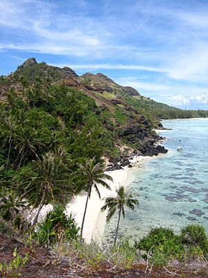
The volcanic islands are covered with thick tropical plants. The side of Mount Duff that faces the wind has dry grassland.
The coral islands on the reef have fewer types of plants. This is because the soil is not very rich. Coconut trees (Cocos nucifera) grow well here. They are used to make copra, which is dried coconut meat.
The animals on the coral islands are mostly birds, insects, and lizards. But the underwater fauna (animals) are very diverse. Many kinds of coral fish live in the lagoon. This makes it a great place for divers.
Island Geology
The Gambier Islands were formed by a hot spot under the Pacific Plate. This plate is slowly moving northwest. The islands formed about 5.6 to 5.7 million years ago. They are part of an atoll. The main island has partly sunk. So, old parts of the volcano crater still stick out of the water. You can still see the shape of the sunken volcano by how the islands are arranged in the lagoon.
The whole island group sits on an underwater rise. This rise sinks quickly in the south and east. Because of this, the 65 km (40 mi) long reef only rises above the water on three sides. From there, many low motus (small islands) rise just above the sea surface. These are made of coral sand and rocks.
Economy of the Gambier Islands
Today, pearl farming is a big part of the economy. Many pearl farms are in the Gambier lagoons. The cooler waters here help produce good quality pearls. There are 129 farms, including fourteen companies. Even though the islands are far from big cities, more people have moved here. This is thanks to pearl farming and collecting mother-of-pearl.
The Gambier Islands are not a very popular place for tourists in French Polynesia. This is because they are far from Tahiti and airfare is expensive. But the islands have potential for tourism. They have a good climate, beautiful nature, and a unique history. Some sailboats visit Rikitea Bay. Tourists going to the British Pitcairn Islands often stop in Mangareva.
Local production in the Gambier Islands is small. It includes farming for food and fishing. Most goods are brought in by cargo ships. These ships come every three weeks.
The people living on the islands grow their own food. They grow yams, taro, and breadfruit. They also grow many kinds of tropical fruits. Some coffee is grown to sell.
Government and Politics
The Gambier Islands are part of French Polynesia. They form one of 17 municipalities (Commune des Gambier). This municipality is managed by a part of the High Commission of French Polynesia in Papeete, Tahiti.
Besides the Gambier Islands themselves, the municipality of Gambier also includes other atolls. These are in the southeast of the Tuamotu archipelago. They include:
- Maturei Vavao Atoll
- Tenararo Atoll
- Tenarunga (or Tenania) Atoll
- Vahanga Atoll
- Maria Atoll
- Marutea Sud Atoll
- Morane Atoll
In 2012, the municipality of Gambier had a total of 1,421 people.
The official language is French. The money used is the CFP franc. This currency is linked to the euro. France and the European Union provide much of the money for the Gambier Islands' budget.
The main island is Mangareva. This is where the local government office is located.
Population of the Gambier Islands
In 2017, the Gambier Islands had a population of 1,431 people.
The people lived on these islands:
- Temoe atoll: no one lives here
- Mangareva Islands:
- Mangareva Island: 1,384 people
- Aukena Island: 25 people
- Akamaru Island: 12 people
- Taravai Island: 8 people
- Angakauitai Island: 1 person
- Kamaka Island: 1 person
| Historical population | ||
|---|---|---|
| Year | Pop. | ±% p.a. |
| 1983 | 553 | — |
| 1988 | 612 | +2.09% |
| 1996 | 873 | +4.54% |
| 2002 | 907 | +0.62% |
| 2007 | 1,098 | +4.08% |
| 2012 | 1,310 | +3.59% |
| 2017 | 1,431 | +1.79% |
| Official population figures from the French Polynesian censuses. | ||
Religion in the Gambier Islands
Most people on the islands are Christian. They are mainly Catholic or belong to Protestant groups. This is because of the missionaries who came to the area.
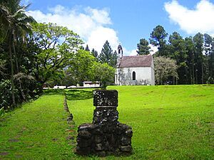
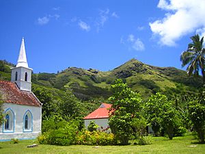
The old cathedral of St. Michael in Mangareva has been restored. It shows the time when the first Catholic missionaries arrived in the 1800s. This building is protected as a historical monument of France. It is seen as an important center for Catholicism in Polynesia.
Catholic missionaries quickly converted almost all the people. They built many religious buildings. They also had the marae, which were places where old local gods were worshipped, destroyed.
Today, the Catholic Church manages six buildings in the area. These include the Church of Saint Gabriel in Taravai and the Church of Our Lady of Peace in Akamaru. The old Cathedral of Saint Michael in Rikitea was a cathedral for Eastern Oceania between 1833 and 1848.
Culture of the Gambier Islands
We do not know much about the art and culture of the Gambier Islands before Europeans arrived. This is because many artworks were destroyed by the colonizers. Father Laval said he burned 40 wooden statues in one day. What little we know about the islands' religion comes from letters written by missionaries.
Frederick William Beechey described a hut with idols. He wrote that a finely carved idol stood in the center. It had cloth tied around its head and waist. Gifts like oars and mats were placed next to it.
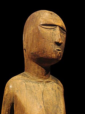
Only eight artifacts from before European times still exist from the Gambier Islands. One is a carved statue of a god named Rao. It is about a meter (3 feet) tall. Rao was believed to be the "god of unfairness."
Another four-armed stand is on display in Paris. A natural-looking statue in the Metropolitan Museum of Art in New York might be the god Rogo. Rogo was the god of peace and kindness. His worship was linked to growing turmeric.
Languages Spoken on the Islands
In 2017, only 24.8% of people aged 15 and older in the Gambier Islands spoke Mangarevan most often at home. This was down from 38.6% in 2007. French was the main language for 62.6% of people. This was up from 52.3% in 2007. Some people also spoke Tahitian or Chinese dialects.
The number of people speaking Mangarevan at home in the Gambier Islands went down. It dropped from 300 in 2007 to 270 in 2017. Most Mangarevan speakers outside the Gambier Islands live in Tahiti.
Mangarevan speakers often also speak Tahitian and French. Mangarevan is related to Hawaiian and Marquesan.
The Endangered Languages Project says Mangarevan is an endangered language. Fewer than 900 people speak it. Most people in the Gambier Islands speak French.
See also
- List of non-marine molluscs of the Gambier Islands
- List of monarchs of Mangareva
 | Delilah Pierce |
 | Gordon Parks |
 | Augusta Savage |
 | Charles Ethan Porter |


