
Tavener, Texas facts for kids
Quick facts for kids
Tavener, Texas
|
|
|---|---|

Tavener cotton gin at US 90A and FM 1952
|
|

Tavener, Texas
Location in Texas

Tavener, Texas
Location in the United States
|
|
| Country | United States |
| State | Texas |
| County | Fort Bend |
| Elevation | 117 ft (36 m) |
| Time zone | UTC-6 (Central (CST)) |
| • Summer (DST) | UTC-5 (CDT) |
| ZIP code |
77435
|
| Area code(s) | 979 |
Tavener is a small place in Fort Bend County, Texas, United States. It's called an "unincorporated community" because it doesn't have its own local government like a city does. Tavener is also part of the bigger Greater Houston area.
History of Tavener
Tavener started as a stop on the Texas and New Orleans Railroad in 1890. It was named after Charlie Tavener, who lived there early on.
In 1910, the community got its own post office. Just four years later, about 25 people lived in Tavener. They had a lumberyard, a general store, and even telephone service.
The post office closed in the 1930s. By 1933, Tavener had grown to 50 people and four businesses. By 1945, only one business was left, but the number of people living there stayed about the same.
In 1953, the population dropped to just 20 people. It went up a bit to 30 people by 1970. Tavener was still shown on county maps in 1987, but there haven't been any population counts since then.
Where is Tavener Located?
Tavener is found in Fort Bend County. It is about 12 miles (19 km) west of Richmond. You can find Tavener along US 90A and Farm to Market Road 1952.
Education in Tavener
In 1926, Tavener had two schools. One school was for 135 white children. The other school was for 28 black children.
Today, students in the Tavener area attend schools run by the Brazos Independent School District.
Images for kids
-

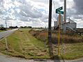
View east at the intersection of US 90A and FM 1952
-
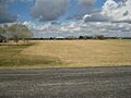
View south from Engel and Buls Roads
-
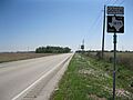
View north from Buls Road toward US 90A
-
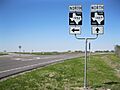
FM 1952 and FM 1489 intersection north of Tavener
-
View south on FM 1875 near US 90A east of Tavener


