Tedieville, Missouri facts for kids
Quick facts for kids
Tedieville, Missouri
|
|
|---|---|
| Country | |
| State | |
| County | Pettis County |
| Township | Longwood Township |
| Elevation | 245 m (804 ft) |
| Time zone | UTC-6 (Central (CST)) |
| • Summer (DST) | UTC-5 (CDT) |
| ZIP code |
65333
|
| GNIS feature ID | 737947 |
Tedieville was a small, unincorporated community located in northern Pettis County, Missouri, in the United States. An "unincorporated community" means it was a group of homes and buildings that didn't have its own official local government, like a city or town.
Where Was Tedieville?
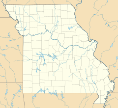
This community was found in the northern part of Pettis County. It was about 4.5 miles (7.2 kilometers) northeast of a place called Houstonia. Tedieville was also located just one mile (1.6 kilometers) south of the line that separates Pettis County from Saline County. You could find it along Missouri Route CC.
History of Tedieville
The Post Office
A post office was opened in Tedieville in the year 1887. This was important because it meant people living there could easily send and receive mail. Having a post office often showed that a community was growing and had enough people to need this service.
However, the post office in Tedieville didn't stay open for very long. It closed down in 1903. This might suggest that the community didn't grow as much as expected, or that people started using post offices in nearby towns instead.
What's in a Name?
It's a bit of a mystery why this community was named "Tedieville." Historians and researchers don't know the exact reason or who it might have been named after. Sometimes, places are named after important people, local families, or even a unique feature of the area, but the story behind Tedieville's name is still unknown.
 | Chris Smalls |
 | Fred Hampton |
 | Ralph Abernathy |


