Tekapo River facts for kids
The Tekapo River is a river in the South Island of New Zealand. It flows through the Mackenzie Basin in the Canterbury Region. Sometimes, the riverbed in the upper parts can be dry. However, it always has water flowing in its lower parts, especially after other smaller rivers like the Maryburn, Forks, and Grays rivers join it.
People who like to fish often visit the lower parts of the Tekapo River. They try to catch brown and rainbow trout. But recently, a type of algae called didymo has grown a lot in the river. This has made it harder for people to fish there.
How the Tekapo River Changed
The Tekapo River used to flow for about 25 kilometers (15 miles) from the bottom of Lake Tekapo. It would then join the Pukaki River and flow into Lake Benmore.
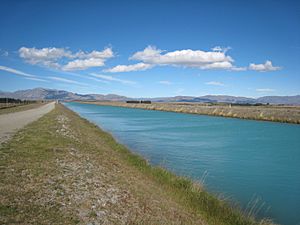
However, things are different now. Most of the water from Lake Tekapo is sent through a special canal to Lake Pukaki. This is part of a big project called the Waitaki hydroelectric scheme. This scheme uses the lakes to store water and make electricity.
Sometimes, if there's a lot of melted snow or if the power stations need to be fixed, water might be released back into the old riverbed from the dam or the canal.
Kayaking on the River
When water is released back into the river, it's a very exciting time for people who love to kayak. They look forward to these events so much that they have even changed parts of the riverbed themselves to create better rapids for kayaking!
In 2020, there was a warning about possible water spills. The river's normal highest level in summer is 709.8 meters (about 2,329 feet) above sea level. But at one point, it reached 709.9 meters (about 2,329.7 feet).
See also
 In Spanish: Río Tékapo para niños
 | Percy Lavon Julian |
 | Katherine Johnson |
 | George Washington Carver |
 | Annie Easley |


