Telire River facts for kids
Quick facts for kids Telire River |
|
|---|---|
| Country | Costa Rica |
| Province | Limón |
| Physical characteristics | |
| River mouth | Sixaola River 9°33′34″N 82°53′09″W / 9.55944°N 82.88583°W |
| Basin features | |
| River system | Sixaola |
The Telire River is an important river in Costa Rica, a country in Central America. It flows through the province of Limón, which is in the eastern part of Costa Rica. This river is special because it helps form a bigger river and even part of a country's border!
About the Telire River
The Telire River is not just any river. It plays a key role in the local geography. When the Telire River meets another river called the Yorkin River, they join together. This meeting point creates a new, larger river known as the Sixaola River.
Where is the Telire River?
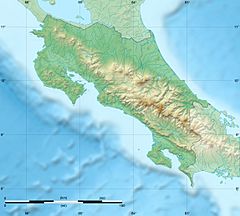
The Telire River is located in the eastern part of Costa Rica. The Sixaola River, which is formed by the Telire, becomes part of the border between Costa Rica and Panama. This means the Telire River indirectly helps mark the line between these two countries.
Weather Around the River
The area where the Telire River flows has a special kind of weather called a rainforest climate. This means it's usually warm and gets a lot of rain.
The average temperature throughout the year is about 22 °C (72 °F). The warmest month is usually October, with temperatures staying around 22 °C. The coolest month is January, when the average temperature drops slightly to about 19 °C (66 °F).
The Telire River area receives a lot of rain every year, about 2,550 millimeters (100 inches) in total. July is typically the rainiest month, with an average of 434 mm (17 inches) of rain. February is the driest month, receiving about 75 mm (3 inches) of rain. This constant rain helps keep the rainforest lush and green.
See also
 In Spanish: Río Telire para niños
 | Claudette Colvin |
 | Myrlie Evers-Williams |
 | Alberta Odell Jones |


