Texhoma, Texas facts for kids
Quick facts for kids
Texhoma, Texas
|
|
|---|---|

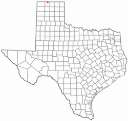
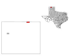
Location of Texhoma, Texas
|
|
 |
|
| Country | United States |
| State | Texas |
| County | Sherman |
| Platted | 1906 |
| Incorporated | 1980 |
| Named for | Texoma |
| Area | |
| • Total | 1.90 sq mi (4.92 km2) |
| • Land | 1.90 sq mi (4.92 km2) |
| • Water | 0.00 sq mi (0.00 km2) |
| Elevation | 3,504 ft (1,068 m) |
| Population
(2020)
|
|
| • Total | 258 |
| • Density | 135.8/sq mi (52.44/km2) |
| Time zone | UTC-6 (Central (CST)) |
| • Summer (DST) | UTC-5 (CDT) |
| ZIP code |
73960
|
| FIPS code | 48-72464 |
| GNIS feature ID | 2412056 |
Texhoma is a small city located in the very northern part of Sherman County, Texas, United States. It is special because the state border between Texas and Oklahoma runs right through it. This means there is also a town called Texhoma, Oklahoma right next door!
In 2020, about 258 people lived in Texhoma, Texas. This city is also the northernmost place you can find in the entire state of Texas.
Contents
Understanding Texhoma's Location
When we talk about a city's geography, we mean where it is located and what its land is like.
According to the United States Census Bureau, Texhoma, Texas, covers a total area of about 1.9 square miles (4.9 square kilometers). All of this area is land; there are no large bodies of water like lakes or rivers within the city limits.
A Look at Texhoma's Past
Texhoma has an interesting history, especially because it sits on a state border.
Early Days and Railroads
The city of Texhoma is located along U.S. Route 54, which is an important road. It was also once a stop on the Chicago, Rock Island and Mexico Railway. Railways were very important for travel and trade in the past.
The community was first planned out in 1906. By 1910, about 300 people lived there. The town got its name from the "Texoma" region, which is a combination of "Texas" and "Oklahoma."
The Border Shift
For a short time, from 1909 to 1910, Texhoma had its own post office. However, it later joined with the post office in Texhoma, Oklahoma.
Something interesting happened in 1932. A new survey was done that moved the state border about 465 feet south. After this change, most of the businesses in the area ended up on the Oklahoma side of the border. Texhoma, Texas, officially became an incorporated city in 1980. This means it gained its own local government.
Who Lives in Texhoma?
Demographics is the study of populations. It helps us understand how many people live in a place and what groups they belong to.
| Historical population | |||
|---|---|---|---|
| Census | Pop. | %± | |
| 1920 | 313 | — | |
| 1930 | 300 | −4.2% | |
| 1940 | 191 | −36.3% | |
| 1950 | 299 | 56.5% | |
| 1960 | 350 | 17.1% | |
| 1970 | 356 | 1.7% | |
| 1980 | 358 | 0.6% | |
| 1990 | 291 | −18.7% | |
| 2000 | 371 | 27.5% | |
| 2010 | 346 | −6.7% | |
| 2020 | 258 | −25.4% | |
| U.S. Decennial Census | |||
Population in 2020
The 2020 United States census counted 258 people living in Texhoma, Texas. These people lived in 183 households, and 93 of these were families.
Here's a quick look at the different groups of people living in Texhoma in 2020:
| Race | Number | Percentage |
|---|---|---|
| White (NH) | 162 | 62.79% |
| Mixed/Multi-Racial (NH) | 8 | 3.1% |
| Hispanic or Latino | 88 | 34.11% |
| Total | 258 |
Learning in Texhoma
Students in Texhoma have a unique schooling experience because of the state border.
School Districts
Children in Texhoma are served by two different school districts. Students from kindergarten through fourth grade attend schools in the Texhoma Independent School District in Texas. Then, for fifth through twelfth grade, students go to Texhoma Public Schools in Oklahoma.
For most of the 1900s, the divided town had just one school district for both sides.
College Opportunities
Because of its special location, Texhoma is the only city in Texas where students who graduate can attend universities in either Texas or Oklahoma and pay the "in-state" tuition rate for both. This can save students and their families a lot of money on college!
See also

- In Spanish: Texhoma (Texas) para niños
 | Kyle Baker |
 | Joseph Yoakum |
 | Laura Wheeler Waring |
 | Henry Ossawa Tanner |

