The Moss facts for kids
Quick facts for kids The Moss |
|
|---|---|

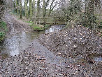
The Moss, just to the north of Troway.
|
|
| Country | |
| Physical characteristics | |
| Main source | Coalpit Wood, Coal Aston, Derbyshire 518 feet (158 m) |
| River mouth | River Rother at Eckington |
| Length | 4.8 miles (7.7 km) |
The Moss is a small river, also known as a brook, located in North East Derbyshire, England. It is an important part of the local landscape.
In the 1980s, when Rother Valley Country Park was built, workers used water from The Moss. This water helped to fill the park's lakes.
Contents
What's in a Name?
The name of this river, The Moss, comes from an old term. It gets its name from Moss Beck. This means 'stream through marshy ground'. So, the name tells us a bit about the area it flows through.
The River's Journey
The Moss starts its journey from a natural spring. This spring is found in a wooded area called Coalpit Wood. This spot is just east of Jordanthorpe Parkway (B6057 road).
The river then flows through a beautiful area called the Moss Valley. It passes through several villages. These include Geerlane, Birley Hay, Ford, and Eckington. The Moss also travels through different woodlands. These woods are Coalpit Wood, Long Wood, and Eckington Park.
Many smaller streams join The Moss along its way. These are called tributaries. Some of the main ones are the Robin Brook, Owler Car Brook, Sickle Brook, Troway Brook, Sloadlane Brook, and Ridgeway Brook.
Finally, The Moss flows into a larger river. It joins the River Rother in Eckington, Derbyshire. This meeting point is close to Eckington Mine.
Exploring Moss Valley
Moss Valley is the name of the valley that The Moss river has created. It is in North East Derbyshire, just south of Sheffield, England. Nearby towns and villages include Charnock, Troway, Eckington, Mosborough, and Ridgeway.
The valley is home to lovely woodlands. These include Eckington Woods and Bluebell Woods. Bluebell Woods gets its name because of the many bluebells that cover the ground in spring. It looks like a purple carpet!
The Moss and its smaller streams have shaped this valley. The whole area covers about 10 square kilometres (3.9 sq mi).
Valley History and Industry
Moss Valley has a long history of industry. This is because it is near a river, coal, and rock.
People have been quarrying (digging for stone) and mining (digging for coal) here for a long time. Most of these quarries and mines are now closed. However, a few are still open. Eckington Coal Mine is one of them. It is a drift mine near where The Moss meets the River Rother. Sicklebrook Quarry in Sicklebrook is also still open.
There are also several old mills in the valley. In some places, The Moss has been blocked by dams. This created reservoirs and mill ponds. These were used to power the mills.
Moss Valley was once famous for making excellent tools. People here were known for producing sickles and scythes.
Fun Activities in the Valley
Moss Valley is a popular place for outdoor activities. Many people enjoy walking, hiking, and cycling here. On sunny days, especially holidays, the woods can be very busy. Families and groups explore the trails or link them to longer walks.
Mountain bikers also love the area. You can often see them on trails on both the Mosborough and Eckington sides of the valley. There are two ponds on the Ridgeway side. These are used for private fishing. There is also a car park and a pub called the Bridge Inn nearby.
Wildlife in Moss Valley
Several parts of Moss Valley are very special for nature. They have been marked as Sites of Special Scientific Interest (SSSIs) by English Nature. This means they are protected because of their importance for wildlife.
The main Moss Valley SSSI is a long strip of land along both sides of The Moss. It is about 25.9 hectares in size. This area is special because it is a great home for invertebrates. These are small creatures without backbones, like insects and worms. This site also has about 5 hectares of a rare type of wet grassland. This is called a floodplain grazing marsh.
Three other areas in the valley are part of the Moss Valley Meadows SSSI. These are mostly along the Robin Brook, one of The Moss's main streams.
- The northern part is the largest. It has forest clearings in Near Hill Clough Wood and Far Hill Clough Wood. These clearings are home to meadow habitats.
- The central part is further south along Robin Brook. It is in clearings within Parson's Wood and Joshua Holt woodland.
- The southern part is an open area near Geerlane. It is where the Robin Brook joins The Moss.
Two more spots in the valley are part of the Moss Valley Woods SSSI. Both are high up on the southern slopes of the valley.
- The western part is larger. It is in Whinacre Wood, Cook Spring Wood, and Owler Car Wood.
- The eastern part is in Moor Mires Wood, Mires Spring Wood, and Brownstorth Wood.
These woods are home to many common English woodland animals. You might see badgers, hares, roe deer, foxes, and rabbits. Owls are also often seen. The area also has 85 different types of moths and butterflies, including the white-letter hairstreak.
 | George Robert Carruthers |
 | Patricia Bath |
 | Jan Ernst Matzeliger |
 | Alexander Miles |

