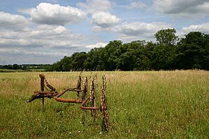
The Warbanks facts for kids
The Warbanks are an archaeological site in Suffolk, England. They are made up of old earthworks, which are like long, bumpy lines on the ground. These earthworks cross the A134 road and are found in the areas of Lawshall, Cockfield, and Shimpling.
What are the Warbanks?
The Warbanks are very old defensive ditches. Imagine deep trenches and raised banks that people built a long, long time ago to protect themselves. They are located on the eastern edge of a village called Lawshall. They also stretch into nearby villages like Cockfield and Shimpling.
These earthworks are extremely ancient. They include long ramparts, which are like walls of earth, and ditches. A Roman road, which is now the A134, crosses through them. This road runs between Alpheton and Bradfield Combust. The Warbanks were once one big defensive system. Now, they are in three main parts. The section in Lawshall is the easiest to see.
Long ago, this area had thick forests on both sides. The ground was also heavy clay. These features, along with the Warbanks, made it a strong military spot.
How Old are the Warbanks?
The Warbanks were built even before the Romans came to Britain. They might have been an earlier defense system. A very old sword was found at the Warbanks site. This sword is from the late Bronze Age, about 800 to 600 BC. It is now kept in the Moyse's Hall Museum in Bury St Edmunds. This sword helps us guess how old the Warbanks might be.
Other interesting items have also been found here. A small bronze statue of a woman was discovered within the earthworks. The woman's hair is braided into twelve twists. It is fastened on top of her head with a bow. Also, a bronze handle from a knife or mirror was found. It has a crowned female head at its end. Even older tools from the Neolithic period have been found at the Warbanks.
Important Dates
The Archaeological Service of Suffolk County Council has recorded some key dates for the Warbanks:
- 1581: One part of the Warbanks was named "Le Barowe."
- 1834/4: An old map, called a Tithe Map, showed a section named "War Bank (wood)."
- 1842: The Warbanks were named "War Bank" on the Tithe Map of Lawshall.
- 1978: People were still plowing the area. The Warbanks were just barely visible.
- 1998: The whole area of the Warbanks east of the A134 was searched with metal detectors. No new metal objects were found.
 | Tommie Smith |
 | Simone Manuel |
 | Shani Davis |
 | Simone Biles |
 | Alice Coachman |


