Alpheton facts for kids
Quick facts for kids Alpheton |
|
|---|---|
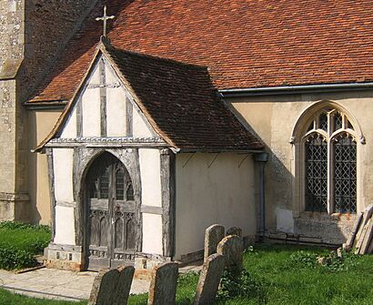
 Church of St Peter and St Paul, Alpheton |
|
| Area | 4.94 km2 (1.91 sq mi) |
| Population | 256 (2011) |
| • Density | 52/km2 (130/sq mi) |
| OS grid reference | TL882507 |
| District |
|
| Shire county | |
| Region | |
| Country | England |
| Sovereign state | United Kingdom |
| Post town | SUDBURY |
| Postcode district | CO10 |
| Dialling code | 01284 |
| Police | Suffolk |
| Fire | Suffolk |
| Ambulance | East of England |
| EU Parliament | East of England |
| UK Parliament |
|
Alpheton is a small village and civil parish in the Babergh area of Suffolk, England. It is located on the A134 road, about six miles north of Sudbury. In 2011, about 256 people lived there. The name "Alpheton" likely comes from "Aelfled's homestead."
Contents
History of Alpheton
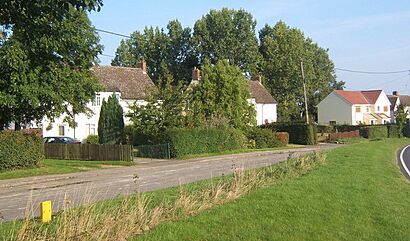
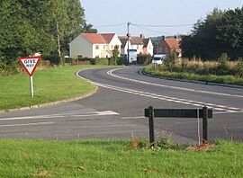
Alpheton is a friendly and active community. You can find homes, both old and new, along the main road (also called Old Bury Road), Church Lane, and Roseacre. To the south of Alpheton is a small area called Bridge Street, which the A134 road also goes through.
How Alpheton Started
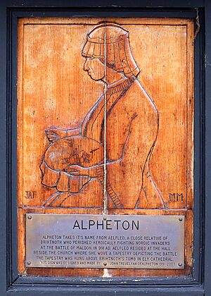
Alpheton was likely founded by a woman named Aefflead. Her husband, Byrthnoth, was an Earl who died in a battle in AD 991. After his death, Aefflead moved north and settled in this area. It was first called Aefflead's Tun, which means Aefflead's estate. She probably lived in Alpheton Hall. Over time, the name changed. In the Domesday Book, it was called Alfreton. The current name, Alpheton, is a newer version of these older names.
Life in the Village Over Time
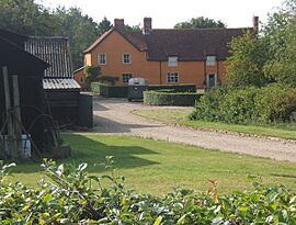
Alpheton has stayed much the same for hundreds of years. It has always been a farming village. Today, there are four main farms: Alpheton Hall, Clapstile Farm, Tye Farm, and Lavenham Lodge. Before the World Wars, many people in the village worked on these farms. Now, the homes are a mix of council houses and privately owned houses.
Alpheton During the World Wars
Many young men from Alpheton fought in the First World War. Their names are remembered on a special tablet in the Church. In 1936, the village school closed, and children had to go to school in Shimpling. The old school building became the Village Hall for a while.
During the Second World War (1939-1945), "Land Girls" from the Women's Land Army came to Alpheton. They helped with farm work and stayed in homes around the village. For example, 30 Land Girls lived in the Old Rectory, which was turned into dorms. Children from London, who were sent away from the city for safety, also came to Alpheton.
In 1941, work began on the Alpheton/Lavenham Airfield on land from Lavenham Lodge Farm. Many workers helped build it. By 1944, American B24 Liberator bombers arrived at the airfield. Later, B17 Flying Fortresses also used the base until the war ended.
Changes After the Wars
After the wars, Alpheton saw some changes. The local pub, The Red Lion, closed in 1964 because fewer people visited it after the main road was changed. The village Post Office and shop also closed in 1975.
How Alpheton is Governed
Alpheton is part of the Babergh area in Suffolk. The village has three levels of local government:
- Suffolk County Council
- Babergh District Council
- The 7-member Alpheton Parish Council, which looks after local village matters.
Village Facilities
- The Church of St Peter and St Paul is at the end of Church Lane, next to Alpheton Hall. It is thought to be from the 10th century.
- The Village Hall was built in 1977 to celebrate Queen Elizabeth II's Silver Jubilee. It is a central place for many village events and activities.
- There is also a small recreation ground next to the Village Hall, where people can play.
Important Buildings (Listed Buildings)
In England, some buildings are "listed" because they are historically or architecturally important. This means they are protected and cannot be changed without special permission. Here are some listed buildings in Alpheton:
Grade I (Most Important)
- St Peter and St Paul Church
Grade II* (Very Important)
- Mill House, Bridge Street
Grade II (Important)
- Alpheton Hall
- Barn at Old Hall Farm
- Elms Farmhouse
- Old Rectory
- Post Office and House adjoining
- Clapstile Farmhouse
- Bridge Cottage, Bridge Street
- Wash Farmhouse, Bridge Street
- Tye Farmhouse, Church Lane
- Thatched Cottage, Church Lane
- Tallage, The Tye
- Woodhall, The Green
- Smithy Cottage, Tye Green
- Tye Green Cottage, Tye Green
Landscape Around Alpheton
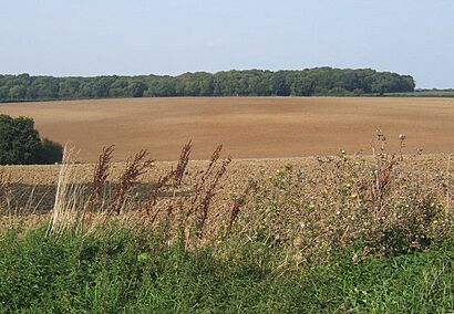
Alpheton is in an area known for its beautiful countryside.
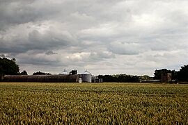
- Rolling Valley Farmlands: This area has small and medium-sized fields on the sides of valleys. These fields were created long ago as common lands were divided up. Villages and towns grew here because the land was good for farming. Old woodlands are mostly found on the higher parts of the valleys.
- Ancient Rolling Farmlands: This landscape has rolling fields with chalky clay and rich soil. Many old, winding hedgerows and ditches still exist, showing how the land was divided long ago. You can see many old farmhouses scattered around. The trees along the hedgerows are usually oak, ash, and maple. The area has a lot of winding roads with wide grassy edges.
Transport
Alpheton has one bus service:
- 375: This bus connects Glemsford / Long Melford to Bury St Edmunds, passing through Alpheton, Shimpling, and Lawshall.
Education
Younger children (aged 5–11) from Alpheton go to All Saint's CEVCP School in Lawshall.
Older children attend Hardwick Middle School and King Edward VI CEVC Upper School in Bury St Edmunds.
Local Groups
- Alpheton Women's Institute: This is a local group for women in the village.
Population Information
In 2001, Alpheton had 242 people living in 96 homes. By 2011, the population grew slightly to 256 people.
The actor Patrick Jordan, who appeared in TV shows and films, passed away in Alpheton on January 10, 2020.
How the Population Has Changed
Here's how the number of people living in Alpheton has changed over many years:
| Population growth in Alpheton from 1801 to 1891 | ||||||||||
|---|---|---|---|---|---|---|---|---|---|---|
| Year | 1801 | 1811 | 1821 | 1831 | 1841 | 1851 | 1881 | 1891 | ||
| Population | 204 | 208 | 264 | 309 | 321 | 370 | 249 | 234 | ||
| Source: A Vision of Britain Through Time | ||||||||||
| Population growth in Alpheton from 1901 to 2001 | ||||||||||
|---|---|---|---|---|---|---|---|---|---|---|
| Year | 1901 | 1911 | 1921 | 1931 | 1951 | 1961 | 2001 | |||
| Population | 244 | 229 | 213 | 189 | 219 | 203 | 242 | |||
| Source: A Vision of Britain Through Time | ||||||||||
Location grid
 |
Shimpling Street | Stanningfield | Cockfield |  |
| Shimpling | Preston St Mary | |||
| Stanstead | Bridge Street | Lavenham |
 | Madam C. J. Walker |
 | Janet Emerson Bashen |
 | Annie Turnbo Malone |
 | Maggie L. Walker |


