Stanstead, Suffolk facts for kids
Quick facts for kids Stanstead |
|
|---|---|
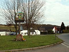
 Village sign, Stanstead, Suffolk |
|
| Population | 319 (2011) |
| District |
|
| Shire county | |
| Region | |
| Country | England |
| Sovereign state | United Kingdom |
| Post town | Sudbury |
| Postcode district | CO10 |
| EU Parliament | East of England |
| UK Parliament |
|
Stanstead is a small village in Suffolk, England. It is also a civil parish, which is a local area with its own council. The village is located about 4 miles (6.4 km) from Sudbury. It is part of the Babergh area.
Stanstead is also close to other towns and villages. It is about 2 km from Glemsford, 12 miles (19 km) from Hadleigh, and 4 miles (6.4 km) from Lavenham.
Contents
What Does the Name Stanstead Mean?
The name Stanstead comes from an old language called Old English. It means "stony place." You can still see why it got this name today. The fields around the village, especially in the lower parts, are full of stones. These stones are called glacial flint and were left behind by ancient glaciers.
People have lived in this area for a very long time. There is proof of settlements from the Iron Age and Ancient Rome nearby.
Where is Stanstead Located?
Stanstead is in the Glem Valley, which is a valley with a river. It is located northeast of Sudbury. The village shares its borders with several other places. To the west is Long Melford, and to the south is Glemsford. Boxted is to the east, and Shimpling is to the north.
The village has a unique T-shape. The lower part, called Lower Street, follows the B1066 road. This road runs along the bottom of the valley. The upper part of the village is on a hill. You climb about 30 meters to reach it. Here you will find Stanstead Hall, the church, and a group of houses. There is also a small green area and then Upper Street and Blooms Hall Lane.
How Stanstead is Governed
Stanstead is part of the Babergh area in Suffolk. The village has three levels of local government that help manage things:
- Suffolk County Council: This is the largest local government for the whole county.
- Babergh District Council: This council looks after the Babergh district, which includes Stanstead.
- Stanstead Parish Council: This is the local council just for the village of Stanstead.
Getting Around Stanstead
The village is served by one bus service. This bus service is run by a company called Hedingham & Chambers.
Schools in Stanstead
Children in Stanstead have local schools they can attend.
- Hartest CEVCP School: This is a primary school for younger students. It teaches children aged 5 to 11 years old.
- Sudbury Upper School and Arts College: Older children from Stanstead go to this school.
How Many People Live in Stanstead?
In 2001, about 316 people lived in Stanstead. These people lived in 127 different homes. The population in 2011 was 319.
How Stanstead's Population Has Changed Over Time
The number of people living in Stanstead has changed a lot over the years. Here's a look at how the population grew and shrank:
| Population growth in Stanstead from 1801 to 1891 | ||||||||||
|---|---|---|---|---|---|---|---|---|---|---|
| Year | 1801 | 1811 | 1821 | 1831 | 1841 | 1851 | 1881 | 1891 | ||
| Population | 258 | 284 | 341 | 353 | 387 | 412 | 369 | 368 | ||
| Source: A Vision of Britain Through Time | ||||||||||
| Population growth in Stanstead from 1901 to 2001 | ||||||||||
|---|---|---|---|---|---|---|---|---|---|---|
| Year | 1901 | 1911 | 1921 | 1931 | 1951 | 1961 | 2001 | |||
| Population | 326 | 265 | 291 | 270 | 247 | 276 | 316 | |||
| Source: A Vision of Britain Through Time | ||||||||||
Famous People From Stanstead
Some interesting people used to live in Stanstead:
- Robert Calef (1648 - 1719): He was a cloth merchant in colonial Boston. He also wrote books.
- Edmund Rice (around 1594 – 1663): He was a politician. He also helped to start the town of Marlborough, Massachusetts.
 | Audre Lorde |
 | John Berry Meachum |
 | Ferdinand Lee Barnett |


